Lloseta night lights from space
Night Light of Lloseta (Balearic Islands) from space (Spain) Src. Average luminocity for 10x10km area is 14.4529% and for 50x50km: 11.4837%.
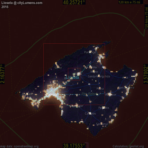
Analysis of Lloseta night lights 2016
Square area 10x10 km:
 0.97%
0.97%90-99
2.92%80-89
1.46%70-79
1.14%60-69
2.11%50-59
2.11%40-49
3.08%30-39
2.11%20-29
1.95%10-19
1.62%0-9
80.52%Square area 50x50 km:
1.91%90-99
1.88%80-89
1.47%70-79
1.06%60-69
1.47%50-59
2%40-49
1.16%30-39
1.69%20-29
2.9%10-19
5.56%0-9
78.89%Clear (daylight) street map image can be seen on geolist.org.
Map coordinates:
40° 15' 26" North, 2° 9' 49.6" East
39° 43' 6.6" North, 2° 52' 0.8" East
39° 10' 31.9" North, 3° 34' 12.1" East
Some cities around Lloseta sort by population:
• Marratxí
16.2 km =10.1 mi,  228°
228°
• Inca
3.8 km =2.4 mi,  85°
85°
• Sóller
14 km =8.7 mi,  292°
292°
• sa Pobla
14.6 km =9.1 mi,  67°
67°
• Santa Margalida
20.2 km =12.6 mi,  95°
95°
• Binissalem
4 km =2.5 mi,  209°
209°
• Muro
16.3 km =10.1 mi,  82°
82°
• Bunyola
14.5 km =9 mi,  260°
260°
2514988 (p: 5,295)
Sources (retrieved 2019-11-25):
» Earth at Night: Flat Maps 2012, 2016