Santander night lights from space
Night Light of Santander (Cantabria) from space (Spain) Src. Average luminocity for 10x10km area is 58.9952% and for 50x50km: 14.7263%.
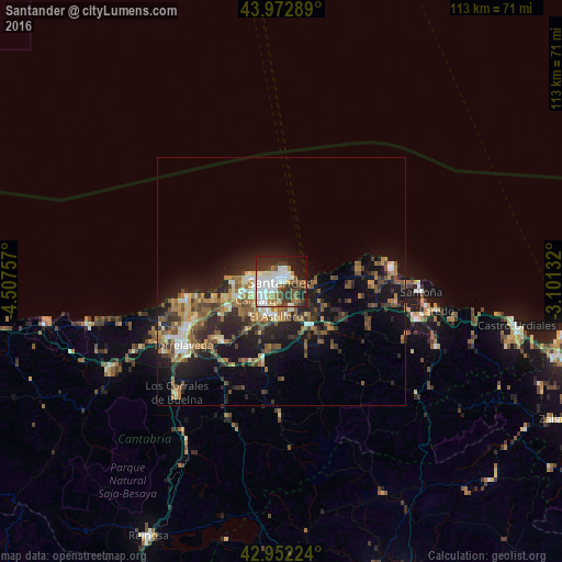
Analysis of Santander night lights 2016
Square area 10x10 km:
 17.94%
90-99
16.19%80-89
3.65%70-79
2.22%60-69
8.1%50-59
8.89%40-49
3.17%30-39
11.11%20-29
15.08%10-19
11.75%0-9
1.9%Square area 50x50 km:
1.47%90-99
2%80-89
1.53%70-79
1.41%60-69
2.84%50-59
3.56%40-49
1.96%30-39
2.69%20-29
5.23%10-19
9.51%0-9
67.8%Clear (daylight) street map image can be seen on geolist.org.
Map coordinates:
43° 58' 22.4" North, 4° 30' 27.3" West
43° 27' 53" North, 3° 48' 16" West
42° 57' 8.1" North, 3° 6' 4.8" West
Some cities around Santander sort by population:
• Torrelavega
23.5 km =14.6 mi,  236°
236°
• Camargo
9.1 km =5.7 mi,  225°
225°
• El Astillero
7.2 km =4.5 mi,  190°
190°
• Santoña
28.1 km =17.5 mi,  94°
94°
• Los Corrales de Buelna
31.1 km =19.3 mi,  224°
224°
• Reocín
27.2 km =16.9 mi, 239°
• Colindres
29.3 km =18.2 mi,  104°
104°
• Suances
19.6 km =12.2 mi,  259°
259°
3109718 (p: 182,700)
Sources (retrieved 2019-11-25):
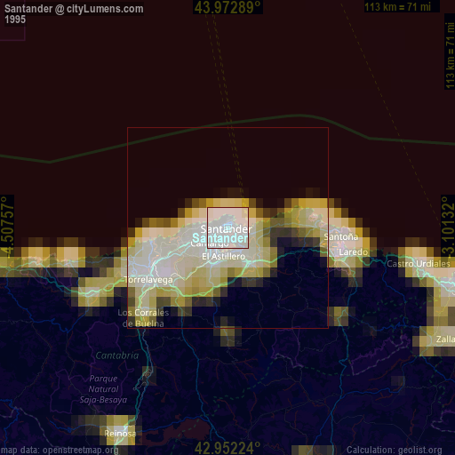
» NASA, Earths city lights 1995
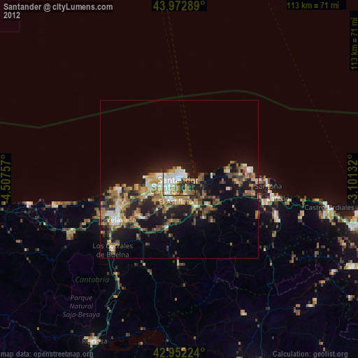
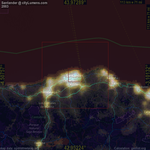
» NASA city lights 2003
» Earth at Night: Flat Maps 2012, 2016