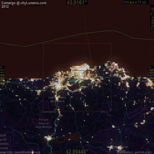
Camargo night lights from space
Night Light of Camargo (Cantabria) from space (Spain) Src. Average luminocity for 10x10km area is 61.1651% and for 50x50km: 14.572%.
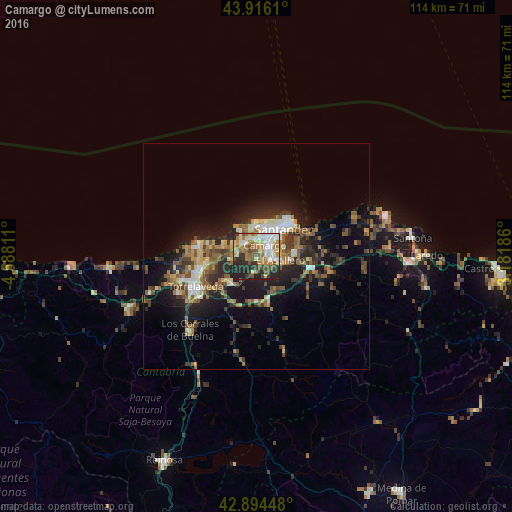
Analysis of Camargo night lights 2016
Square area 10x10 km:
 9.37%
9.37%90-99
13.81%80-89
9.68%70-79
7.94%60-69
14.44%50-59
8.1%40-49
7.14%30-39
5.87%20-29
20.32%10-19
3.33%0-9
0%Square area 50x50 km:
1.45%90-99
1.97%80-89
1.55%70-79
1.34%60-69
2.74%50-59
3.52%40-49
1.95%30-39
2.63%20-29
5.27%10-19
9.16%0-9
68.42%Clear (daylight) street map image can be seen on geolist.org.
Map coordinates:
43° 54' 58" North, 4° 35' 17.2" West
43° 24' 26.8" North, 3° 53' 5.9" West
42° 53' 40.1" North, 3° 10' 54.7" West
Some cities around Camargo sort by population:
• Santander
9.1 km =5.7 mi,  45°
45°
• Torrelavega
14.7 km =9.1 mi,  243°
243°
• El Astillero
5.3 km =3.3 mi,  97°
97°
• Los Corrales de Buelna
22 km =13.7 mi,  223°
223°
• Santa Cruz de Bezana
4.3 km =2.7 mi,  339°
339°
• Reocín
18.5 km =11.5 mi,  245°
245°
• Suances
13.1 km =8.1 mi,  282°
282°
• Santa María de Cayón
11.7 km =7.3 mi,  160°
160°
3126917 (p: 31,404)
Sources (retrieved 2019-11-25):
» Earth at Night: Flat Maps 2012, 2016