Santa Ponsa night lights from space
Night Light of Santa Ponsa (Balearic Islands) from space (Spain) Src. Average luminocity for 10x10km area is 36.2597% and for 50x50km: 10.2767%.
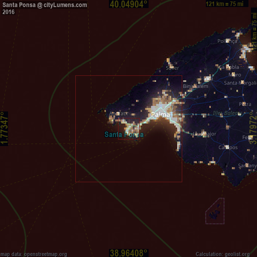
Analysis of Santa Ponsa night lights 2016
Square area 10x10 km:
 2.44%
2.44%90-99
5.68%80-89
7.47%70-79
3.73%60-69
8.28%50-59
6.33%40-49
3.08%30-39
3.41%20-29
7.79%10-19
39.77%0-9
12.01%Square area 50x50 km:
1.87%90-99
1.81%80-89
1.23%70-79
0.98%60-69
1.41%50-59
1.62%40-49
0.97%30-39
1.26%20-29
3.02%10-19
6.98%0-9
78.86%Clear (daylight) street map image can be seen on geolist.org.
Map coordinates:
40° 2' 56.5" North, 1° 46' 24.5" East
39° 30' 31.2" North, 2° 28' 35.8" East
38° 57' 50.7" North, 3° 10' 47" East
Some cities around Santa Ponsa sort by population:
• Palma
16.3 km =10.1 mi,  65°
65°
• Calvià
6.8 km =4.2 mi,  21°
21°
• Andratx
8.9 km =5.5 mi,  326°
326°
• Coll d'en Rabassa
19.3 km =12 mi,  75°
75°
• Es Molinar
18 km =11.2 mi, 71°
• Palmanova
5.7 km =3.5 mi, 71°
• Son Ferrer
2.5 km =1.6 mi,  122°
122°
• Can Pastilla
20.9 km =13 mi, 81°
6324533 (p: 10,736)
Sources (retrieved 2019-11-25):
» Earth at Night: Flat Maps 2012, 2016