Palmanova night lights from space
Night Light of Palmanova (Balearic Islands) from space (Spain) Src. Average luminocity for 10x10km area is 37.3701% and for 50x50km: 11.1952%.
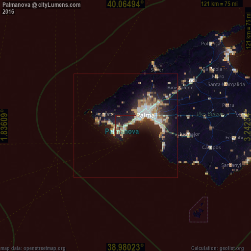
Analysis of Palmanova night lights 2016
Square area 10x10 km:
 2.92%
2.92%90-99
6.33%80-89
5.36%70-79
5.52%60-69
6.98%50-59
5.19%40-49
3.73%30-39
2.92%20-29
14.94%10-19
39.61%0-9
6.49%Square area 50x50 km:
1.88%90-99
1.84%80-89
1.35%70-79
1.01%60-69
1.59%50-59
1.75%40-49
1.04%30-39
1.46%20-29
3.33%10-19
8.23%0-9
76.53%Clear (daylight) street map image can be seen on geolist.org.
Map coordinates:
40° 3' 53.8" North, 1° 50' 9.9" East
39° 31' 28.9" North, 2° 32' 21.2" East
38° 58' 48.8" North, 3° 14' 32.4" East
Some cities around Palmanova sort by population:
• Calvià
5.4 km =3.4 mi,  328°
328°
• Andratx
11.7 km =7.3 mi,  298°
298°
• Santa Ponsa
5.7 km =3.5 mi,  251°
251°
• Coll d'en Rabassa
13.6 km =8.5 mi,  77°
77°
• s'Arenal
18.3 km =11.4 mi,  98°
98°
• Es Molinar
12.4 km =7.7 mi,  70°
70°
• Son Ferrer
4.5 km =2.8 mi,  226°
226°
• Can Pastilla
15.4 km =9.6 mi,  85°
85°
6355010 (p: 7,040)
Sources (retrieved 2019-11-25):
» Earth at Night: Flat Maps 2012, 2016