Santa Maria de Palautordera night lights from space
Night Light of Santa Maria de Palautordera (Catalonia) from space (Spain) Src. Average luminocity for 10x10km area is 32.0909% and for 50x50km: 26.1962%.
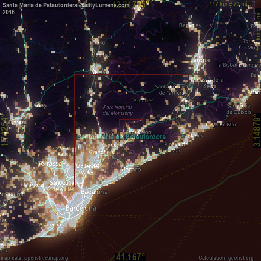
Analysis of Santa Maria de Palautordera night lights 2016
Square area 10x10 km:
 2.6%
2.6%90-99
2.92%80-89
5.03%70-79
4.71%60-69
4.06%50-59
8.28%40-49
2.76%30-39
6.01%20-29
10.23%10-19
37.34%0-9
16.07%Square area 50x50 km:
3.72%90-99
4.84%80-89
3.57%70-79
3.31%60-69
4.29%50-59
3.81%40-49
3.07%30-39
3.09%20-29
6.24%10-19
16.85%0-9
47.21%Clear (daylight) street map image can be seen on geolist.org.
Map coordinates:
42° 13' 1.4" North, 1° 44' 33.1" East
41° 41' 39" North, 2° 26' 44.4" East
41° 10' 1.2" North, 3° 8' 55.6" East
Some cities around Santa Maria de Palautordera sort by population:
• Sant Celoni
3.7 km =2.3 mi,  98°
98°
• Cardedeu
9.5 km =5.9 mi,  230°
230°
• Arenys de Mar
15.2 km =9.4 mi,  145°
145°
• la Garriga
13.5 km =8.4 mi,  264°
264°
• Sant Andreu de Llavaneres
14.5 km =9 mi,  167°
167°
• Arenys de Munt
11.8 km =7.3 mi,  138°
138°
• L'Ametlla del Vallès
15.2 km =9.4 mi, 258°
• Sant Vicenç de Montalt
13.9 km =8.6 mi,  157°
157°
3109764 (p: 7,739)
Sources (retrieved 2019-11-25):
» Earth at Night: Flat Maps 2012, 2016