Sant Gervasi - Galvany night lights from space
Night Light of Sant Gervasi - Galvany (Catalonia) from space (Spain) Src. Average luminocity for 10x10km area is 94.0187% and for 50x50km: 42.8467%.

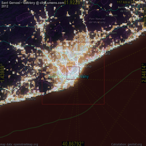
Analysis of Sant Gervasi - Galvany night lights 2016
Square area 10x10 km:
 58.5%
58.5%90-99
25.17%80-89
1.02%70-79
6.29%60-69
5.44%50-59
2.21%40-49
1.19%30-39
0.17%20-29
0%10-19
0%0-9
0%Square area 50x50 km:
11.57%90-99
10.3%80-89
4.06%70-79
5.22%60-69
7.49%50-59
5.72%40-49
3.52%30-39
3.9%20-29
7.13%10-19
6.68%0-9
34.42%Clear (daylight) street map image can be seen on geolist.org.
Map coordinates:
41° 55' 22.1" North, 1° 26' 23.6" East
41° 23' 51" North, 2° 8' 34.8" East
40° 52' 4.5" North, 2° 50' 46.1" East
Some cities around Sant Gervasi - Galvany sort by population:
• Sarrià-Sant Gervasi
0.5 km =0.3 mi,  322°
322°
• Gràcia
1.2 km =0.7 mi,  64°
64°
• la Vila de Gràcia
1.3 km =0.8 mi, 61°
• Barri de les Corts
1.4 km =0.9 mi,  210°
210°
• l'Antiga Esquerra de l'Eixample
1.4 km =0.9 mi,  131°
131°
• el Putxet i el Farró
1.1 km =0.7 mi,  4°
4°
• La Bonanova
1.3 km =0.8 mi, 316°
• Las Tres Torres
1.2 km =0.7 mi,  283°
283°
11549789 (p: 47,043)
Sources (retrieved 2019-11-25):
» Earth at Night: Flat Maps 2012, 2016