Montbau night lights from space
Night Light of Montbau (Catalonia) from space (Spain) Src. Average luminocity for 10x10km area is 85.3997% and for 50x50km: 46.3967%.
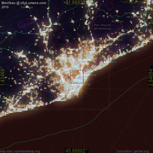
Analysis of Montbau night lights 2016
Square area 10x10 km:
 35.2%
35.2%90-99
19.56%80-89
3.23%70-79
14.12%60-69
26.02%50-59
1.87%40-49
0%30-39
0%20-29
0%10-19
0%0-9
0%Square area 50x50 km:
11.86%90-99
10.79%80-89
4.56%70-79
5.69%60-69
8.39%50-59
6.37%40-49
3.99%30-39
4.54%20-29
8.33%10-19
8.92%0-9
26.56%Clear (daylight) street map image can be seen on geolist.org.
Map coordinates:
41° 57' 37" North, 1° 26' 4.9" East
41° 26' 7" North, 2° 8' 16.1" East
40° 54' 21.7" North, 2° 50' 27.4" East
Some cities around Montbau sort by population:
• Horta
1.6 km =1 mi,  86°
86°
• el Turó de la Peira
2.6 km =1.6 mi,  97°
97°
• la Guineueta
2.6 km =1.6 mi,  81°
81°
• la Teixonera
1.5 km =0.9 mi,  151°
151°
• el Coll
2.2 km =1.4 mi,  158°
158°
• Canyelles
2.4 km =1.5 mi,  62°
62°
• Sant Genís dels Agudells
1.3 km =0.8 mi,  210°
210°
• la Vall d'Hebron
1 km =0.6 mi,  121°
121°
11549768 (p: 5,110)
Sources (retrieved 2019-11-25):
» Earth at Night: Flat Maps 2012, 2016