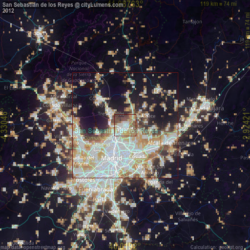
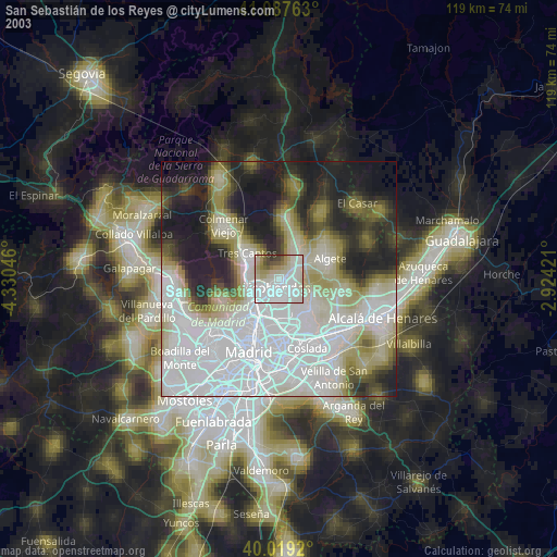
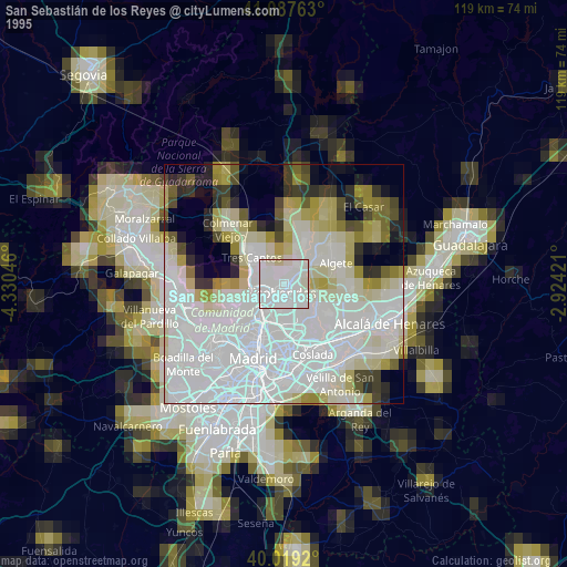
San Sebastián de los Reyes night lights from space
Night Light of San Sebastián de los Reyes (Madrid) from space (Spain) Src. Average luminocity for 10x10km area is 65.2565% and for 50x50km: 47.2733%.
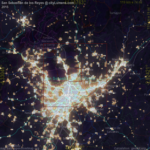
Analysis of San Sebastián de los Reyes night lights 2016
Square area 10x10 km:
 14.94%
90-99
14.94%80-89
4.22%70-79
11.85%60-69
12.99%50-59
6.33%40-49
8.6%30-39
13.8%20-29
12.34%10-19
0%0-9
0%Square area 50x50 km:
13.73%90-99
11.72%80-89
4.14%70-79
5.43%60-69
5.3%50-59
4.76%40-49
4.46%30-39
4.64%20-29
7.36%10-19
15.7%0-9
22.76%Clear (daylight) street map image can be seen on geolist.org.
Map coordinates:
41° 5' 15.5" North, 4° 19' 49.7" West
40° 33' 20" North, 3° 37' 38.4" West
40° 1' 9.1" North, 2° 55' 27.2" West
Some cities around San Sebastián de los Reyes sort by population:
• Fuencarral-El Pardo
10.9 km =6.8 mi,  234°
234°
• Hortaleza
9.1 km =5.7 mi,  187°
187°
• Chamartín
11.2 km =7 mi,  201°
201°
• Alcobendas
1.5 km =0.9 mi, 233°
• Barajas de Madrid
10 km =6.2 mi,  155°
155°
• Tres Cantos
8.5 km =5.3 mi,  306°
306°
• Pinar de Chamartín
9.2 km =5.7 mi, 202°
• Paracuellos de Jarama
10.2 km =6.3 mi,  124°
124°
3110040 (p: 75,912)
Sources (retrieved 2019-11-25):
» NASA, Earths city lights 1995
» NASA city lights 2003
» Earth at Night: Flat Maps 2012, 2016