Donostia / San Sebastián night lights from space
Night Light of Donostia / San Sebastián (Basque Country) from space (Spain) Src. Average luminocity for 10x10km area is 58.8258% and for 50x50km: 10.0086%.
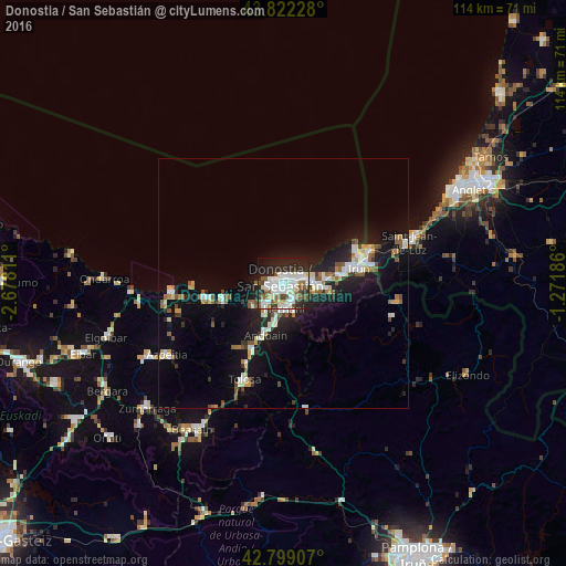
Analysis of Donostia / San Sebastián night lights 2016
Square area 10x10 km:
 20.76%
90-99
16.06%80-89
3.48%70-79
1.36%60-69
4.24%50-59
9.24%40-49
4.55%30-39
5%20-29
21.21%10-19
12.27%0-9
1.82%Square area 50x50 km:
1.92%90-99
1.88%80-89
0.68%70-79
0.69%60-69
0.95%50-59
1.62%40-49
0.78%30-39
0.99%20-29
3.19%10-19
8.36%0-9
78.94%Clear (daylight) street map image can be seen on geolist.org.
Map coordinates:
43° 49' 20.2" North, 2° 40' 41.2" West
43° 18' 46.2" North, 1° 58' 30" West
42° 47' 56.7" North, 1° 16' 18.7" West
Some cities around Donostia / San Sebastián sort by population:
• Errenteria
5.9 km =3.7 mi,  90°
90°
• Hernani
5.2 km =3.2 mi,  181°
181°
• Oria
7.3 km =4.5 mi,  209°
209°
• Lasarte
6.3 km =3.9 mi,  217°
217°
• Pasaia
4.1 km =2.5 mi,  70°
70°
• Lezo
6.3 km =3.9 mi,  81°
81°
• Urnieta
7.4 km =4.6 mi,  189°
189°
• Usurbil
7.5 km =4.7 mi,  232°
232°
3110044 (p: 185,357)
Sources (retrieved 2019-11-25):
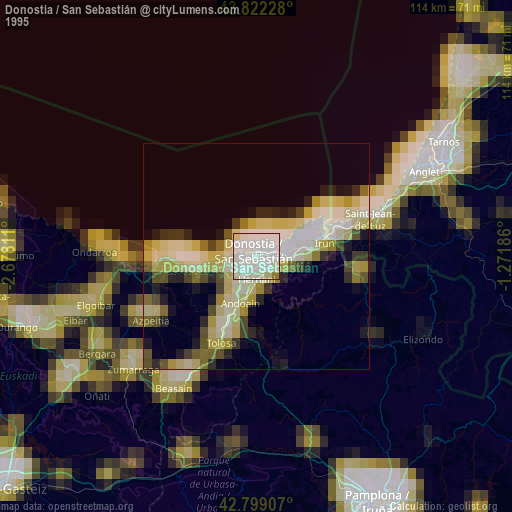
» NASA, Earths city lights 1995
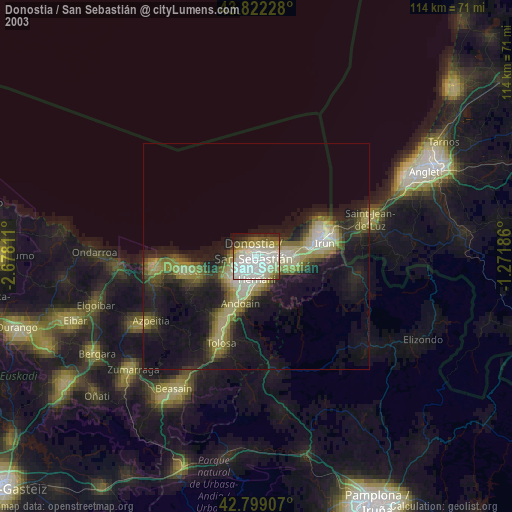
» NASA city lights 2003
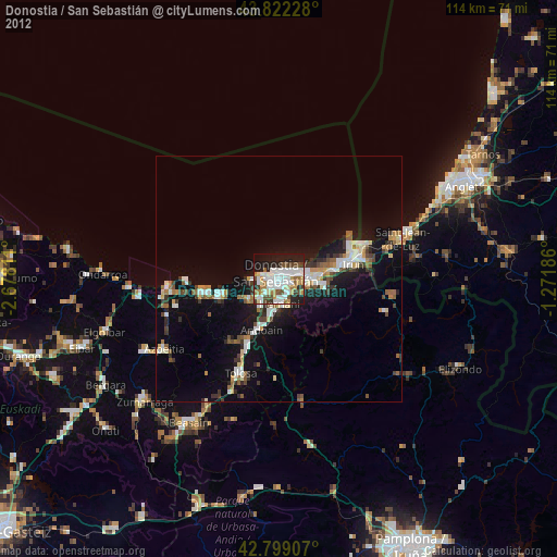
» Earth at Night: Flat Maps 2012, 2016