Lasarte night lights from space
Night Light of Lasarte (Basque Country) from space (Spain) Src. Average luminocity for 10x10km area is 48.4242% and for 50x50km: 10.747%.
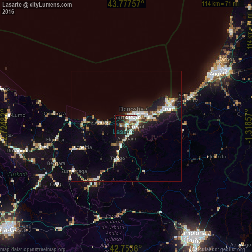
Analysis of Lasarte night lights 2016
Square area 10x10 km:
 15.61%
90-99
12.73%80-89
2.27%70-79
1.52%60-69
3.48%50-59
8.48%40-49
3.48%30-39
5.45%20-29
13.79%10-19
23.94%0-9
9.24%Square area 50x50 km:
2.07%90-99
1.99%80-89
0.78%70-79
0.83%60-69
0.93%50-59
1.57%40-49
0.84%30-39
1.11%20-29
3.27%10-19
8.69%0-9
77.92%Clear (daylight) street map image can be seen on geolist.org.
Map coordinates:
43° 46' 39.3" North, 2° 43' 29.4" West
43° 16' 3.9" North, 2° 1' 18.1" West
42° 45' 13" North, 1° 19' 6.9" West
Some cities around Lasarte sort by population:
• Donostia / San Sebastián
6.3 km =3.9 mi,  37°
37°
• Hernani
3.7 km =2.3 mi,  92°
92°
• Oria
1.4 km =0.9 mi,  170°
170°
• Pasaia
10 km =6.2 mi,  50°
50°
• Andoain
5.7 km =3.5 mi,  182°
182°
• Urnieta
3.4 km =2.1 mi,  132°
132°
• Villabona
9.5 km =5.9 mi,  195°
195°
• Usurbil
2.3 km =1.4 mi,  281°
281°
3119027 (p: 17,782)
Sources (retrieved 2019-11-25):
» Earth at Night: Flat Maps 2012, 2016