Lezo night lights from space
Night Light of Lezo (Basque Country) from space (Spain) Src. Average luminocity for 10x10km area is 46.3015% and for 50x50km: 9.8166%.
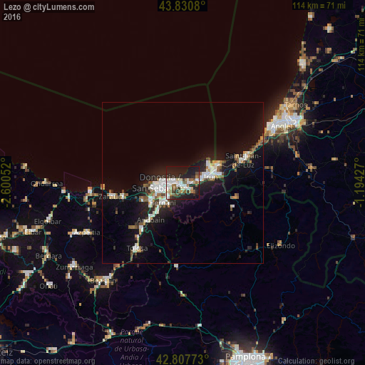
Analysis of Lezo night lights 2016
Square area 10x10 km:
 11.06%
90-99
9.55%80-89
5.15%70-79
1.36%60-69
6.21%50-59
7.88%40-49
3.18%30-39
4.55%20-29
22.27%10-19
28.18%0-9
0.61%Square area 50x50 km:
1.94%90-99
1.82%80-89
0.64%70-79
0.56%60-69
0.91%50-59
1.63%40-49
0.84%30-39
0.98%20-29
3.17%10-19
8.98%0-9
78.53%Clear (daylight) street map image can be seen on geolist.org.
Map coordinates:
43° 49' 50.9" North, 2° 36' 1.9" West
43° 19' 17.1" North, 1° 53' 50.6" West
42° 48' 27.8" North, 1° 11' 39.4" West
Some cities around Lezo sort by population:
• Donostia / San Sebastián
6.3 km =3.9 mi,  261°
261°
• Irun
9 km =5.6 mi,  77°
77°
• Errenteria
1.1 km =0.7 mi,  200°
200°
• Hernani
8.9 km =5.5 mi,  226°
226°
• Hondarribia
9.7 km =6 mi,  57°
57°
• Pasaia
2.4 km =1.5 mi,  280°
280°
• Hendaye, FR
11.5 km =7.1 mi, 60°
• Urnieta
11.2 km =7 mi,  222°
222°
3118469 (p: 5,867)
Sources (retrieved 2019-11-25):
» Earth at Night: Flat Maps 2012, 2016