Puerto del Rosario night lights from space
Night Light of Puerto del Rosario (Canary Islands) from space (Spain) Src. Average luminocity for 10x10km area is 30.1389% and for 50x50km: 4.6095%.
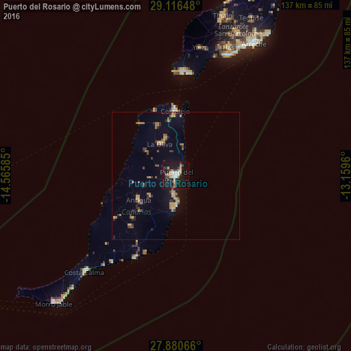
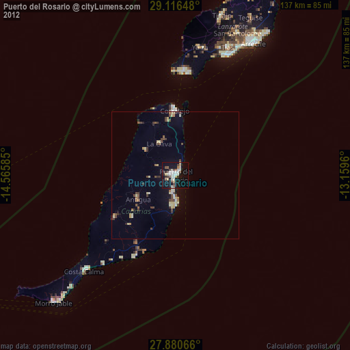
Analysis of Puerto del Rosario night lights 2016
Square area 10x10 km:
 2.78%
2.78%90-99
6.75%80-89
4.37%70-79
5.16%60-69
0.2%50-59
2.98%40-49
1.79%30-39
6.94%20-29
4.76%10-19
43.65%0-9
20.63%Square area 50x50 km:
0.14%90-99
0.35%80-89
0.8%70-79
0.84%60-69
0.62%50-59
0.53%40-49
0.61%30-39
0.82%20-29
0.97%10-19
3.01%0-9
91.31%Clear (daylight) street map image can be seen on geolist.org.
Map coordinates:
29° 6' 59.3" North, 14° 33' 57.1" West
28° 30' 1.4" North, 13° 51' 45.8" West
27° 52' 50.4" North, 13° 9' 34.6" West
Some cities around Puerto del Rosario sort by population:
• La Oliva
13.9 km =8.6 mi,  332°
332°
• Pájara
29.2 km =18.1 mi,  235°
235°
• Tuineje
26.7 km =16.6 mi,  222°
222°
• Corralejo
25.6 km =15.9 mi,  358°
358°
• Antigua
17.1 km =10.6 mi, 239°
• Playa Blanca
40.6 km =25.2 mi,  4°
4°
• Yaiza
51.6 km =32.1 mi,  10°
10°
• Costa Calma
51.9 km =32.2 mi, 223°
2512186 (p: 35,667)
Sources (retrieved 2019-11-25):
» Earth at Night: Flat Maps 2012, 2016