Yaiza night lights from space
Night Light of Yaiza (Canary Islands) from space (Spain) Src. Average luminocity for 10x10km area is 5.6964% and for 50x50km: 7.2887%.
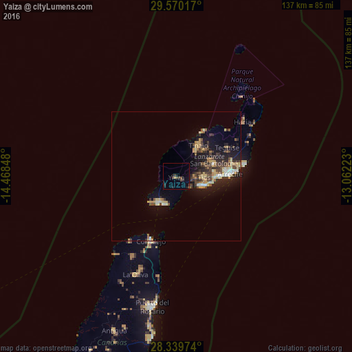
Analysis of Yaiza night lights 2016
Square area 10x10 km:
 0%
0%90-99
0%80-89
0%70-79
0.79%60-69
0%50-59
1.59%40-49
1.59%30-39
1.59%20-29
3.97%10-19
1.98%0-9
88.49%Square area 50x50 km:
0.54%90-99
0.75%80-89
1.37%70-79
1.05%60-69
0.65%50-59
0.81%40-49
1.42%30-39
1.7%20-29
2%10-19
5.61%0-9
84.09%Clear (daylight) street map image can be seen on geolist.org.
Map coordinates:
29° 34' 12.6" North, 14° 28' 6.5" West
28° 57' 24.4" North, 13° 45' 55.3" West
28° 20' 23.1" North, 13° 3' 44" West
Some cities around Yaiza sort by population:
• Arrecife
21.2 km =13.2 mi,  88°
88°
• Puerto del Carmen
10.4 km =6.5 mi,  111°
111°
• Tías
11.7 km =7.3 mi, 87°
• Teguise
22.7 km =14.1 mi,  59°
59°
• San Bartolomé
15.6 km =9.7 mi,  71°
71°
• Nazaret
21.6 km =13.4 mi, 65°
• Playa Blanca
12 km =7.5 mi,  210°
210°
• Tinajo
14.7 km =9.1 mi,  36°
36°
2509408 (p: 8,777)
Sources (retrieved 2019-11-25):
» Earth at Night: Flat Maps 2012, 2016