Pollença night lights from space
Night Light of Pollença (Balearic Islands) from space (Spain) Src. Average luminocity for 10x10km area is 6.5629% and for 50x50km: 3.5026%.
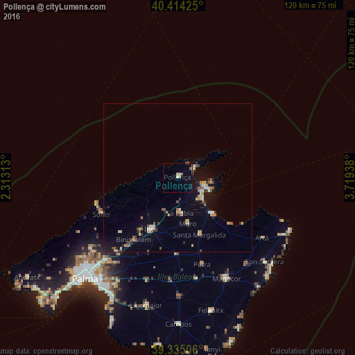
Analysis of Pollença night lights 2016
Square area 10x10 km:
 0.17%
0.17%90-99
0.68%80-89
1.53%70-79
1.02%60-69
0.85%50-59
1.53%40-49
0%30-39
0%20-29
0.34%10-19
0.34%0-9
93.54%Square area 50x50 km:
0.2%90-99
0.44%80-89
0.51%70-79
0.45%60-69
0.51%50-59
0.68%40-49
0.33%30-39
0.29%20-29
0.43%10-19
2.04%0-9
94.14%Clear (daylight) street map image can be seen on geolist.org.
Map coordinates:
40° 24' 51.3" North, 2° 18' 47.3" East
39° 52' 36.4" North, 3° 0' 58.5" East
39° 20' 6.2" North, 3° 43' 9.8" East
Some cities around Pollença sort by population:
• Inca
19.5 km =12.1 mi,  207°
207°
• Alcúdia
9.3 km =5.8 mi,  106°
106°
• sa Pobla
12 km =7.5 mi,  176°
176°
• Santa Margalida
20.8 km =12.9 mi,  159°
159°
• Can Picafort
17.1 km =10.6 mi,  136°
136°
• Muro
15.9 km =9.9 mi,  167°
167°
• Port de Pollença
6.5 km =4 mi,  58°
58°
• Lloseta
21.7 km =13.5 mi,  215°
215°
2512432 (p: 17,260)
Sources (retrieved 2019-11-25):
» Earth at Night: Flat Maps 2012, 2016