Nueva-Carteya night lights from space
Night Light of Nueva-Carteya (Andalusia) from space (Spain) Src. Average luminocity for 10x10km area is 2.2381% and for 50x50km: 5.0291%.
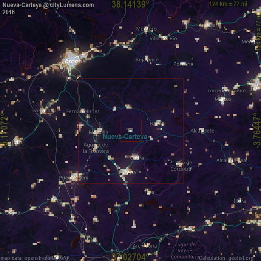
Analysis of Nueva-Carteya night lights 2016
Square area 10x10 km:
 0%
0%90-99
0%80-89
0.68%70-79
0%60-69
0%50-59
0%40-49
0.68%30-39
2.04%20-29
1.53%10-19
0.17%0-9
94.9%Square area 50x50 km:
0.43%90-99
0.73%80-89
1.06%70-79
0.48%60-69
0.6%50-59
0.37%40-49
0.43%30-39
0.86%20-29
0.52%10-19
2.63%0-9
91.89%Clear (daylight) street map image can be seen on geolist.org.
Map coordinates:
38° 8' 29" North, 5° 10' 14.6" West
37° 35' 10.7" North, 4° 28' 3.3" West
37° 1' 37.3" North, 3° 45' 52.1" West
Some cities around Nueva-Carteya sort by population:
• Lucena
19.8 km =12.3 mi,  184°
184°
• Montilla
15 km =9.3 mi,  269°
269°
• Cabra
12.9 km =8 mi,  169°
169°
• Baena
13.2 km =8.2 mi,  75°
75°
• Aguilar
18.5 km =11.5 mi,  244°
244°
• Castro del Río
11.7 km =7.3 mi,  354°
354°
• La Rambla
24.1 km =15 mi,  275°
275°
• Doña Mencía
10.5 km =6.5 mi,  110°
110°
2513184 (p: 5,561)
Sources (retrieved 2019-11-25):
» Earth at Night: Flat Maps 2012, 2016