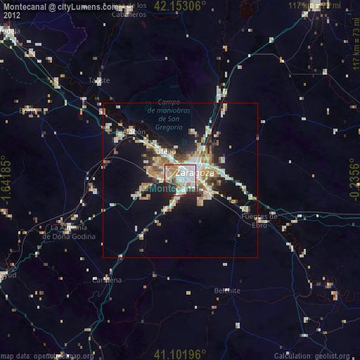
Montecanal night lights from space
Night Light of Montecanal (Aragon) from space (Spain) Src. Average luminocity for 10x10km area is 72.9594% and for 50x50km: 15.8615%.
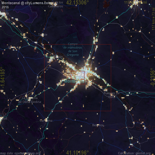
Analysis of Montecanal night lights 2016
Square area 10x10 km:
 27.11%
90-99
17.69%80-89
2.92%70-79
7.47%60-69
13.47%50-59
7.95%40-49
5.36%30-39
6.82%20-29
10.23%10-19
0.97%0-9
0%Square area 50x50 km:
2.82%90-99
2.51%80-89
2.03%70-79
1.88%60-69
2.14%50-59
1.97%40-49
1.54%30-39
2.06%20-29
4.42%10-19
10%0-9
68.62%Clear (daylight) street map image can be seen on geolist.org.
Map coordinates:
42° 9' 11" North, 1° 38' 30.7" West
41° 37' 46.7" North, 0° 56' 19.4" West
41° 6' 7.1" North, 0° 14' 8.2" West
Some cities around Montecanal sort by population:
• Zaragoza
5.9 km =3.7 mi,  60°
60°
• Delicias
3.4 km =2.1 mi,  49°
49°
• Oliver-Valdefierro
1.7 km =1.1 mi,  14°
14°
• Almozara
4.7 km =2.9 mi,  41°
41°
• Utebo
10.1 km =6.3 mi,  330°
330°
• La Almunia de Doña Godina
40.1 km =24.9 mi,  244°
244°
• Alagón
21.6 km =13.4 mi,  316°
316°
• Zuera
29.2 km =18.1 mi,  25°
25°
6615443 (p: 20,000)
Sources (retrieved 2019-11-25):
» Earth at Night: Flat Maps 2012, 2016