Utebo night lights from space
Night Light of Utebo (Aragon) from space (Spain) Src. Average luminocity for 10x10km area is 48.224% and for 50x50km: 16.3383%.
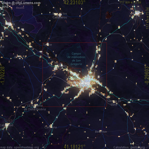
Analysis of Utebo night lights 2016
Square area 10x10 km:
 8.12%
8.12%90-99
7.79%80-89
4.22%70-79
8.77%60-69
6.01%50-59
8.44%40-49
8.93%30-39
7.63%20-29
18.34%10-19
18.18%0-9
3.57%Square area 50x50 km:
2.89%90-99
2.58%80-89
2.23%70-79
1.84%60-69
2.21%50-59
2.06%40-49
1.49%30-39
2.03%20-29
4.44%10-19
10.14%0-9
68.08%Clear (daylight) street map image can be seen on geolist.org.
Map coordinates:
42° 13' 51.7" North, 1° 42' 8.2" West
41° 42' 29.7" North, 0° 59' 57" West
41° 10' 52.4" North, 0° 17' 45.7" West
Some cities around Utebo sort by population:
• Zaragoza
11.7 km =7.3 mi,  119°
119°
• Delicias
10 km =6.2 mi,  130°
130°
• Oliver-Valdefierro
8.9 km =5.5 mi,  142°
142°
• Almozara
9.6 km =6 mi, 122°
• Montecanal
10.1 km =6.3 mi,  150°
150°
• Tauste
31.4 km =19.5 mi,  317°
317°
• Alagón
12.1 km =7.5 mi,  304°
304°
• Zuera
24.8 km =15.4 mi,  44°
44°
3107139 (p: 17,677)
Sources (retrieved 2019-11-25):
» Earth at Night: Flat Maps 2012, 2016