Llucmajor night lights from space
Night Light of Llucmajor (Balearic Islands) from space (Spain) Src. Average luminocity for 10x10km area is 8.3847% and for 50x50km: 10.0873%.
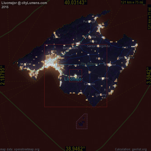

Analysis of Llucmajor night lights 2016
Square area 10x10 km:
 0.49%
0.49%90-99
0.49%80-89
1.79%70-79
1.14%60-69
0.32%50-59
1.3%40-49
1.95%30-39
2.27%20-29
1.62%10-19
2.11%0-9
86.53%Square area 50x50 km:
1.79%90-99
1.63%80-89
1.29%70-79
0.8%60-69
1.22%50-59
1.85%40-49
1.15%30-39
1.61%20-29
2.59%10-19
4.35%0-9
81.72%Clear (daylight) street map image can be seen on geolist.org.
Map coordinates:
40° 1' 53.1" North, 2° 11' 16.6" East
39° 29' 27.3" North, 2° 53' 27.9" East
38° 56' 46.3" North, 3° 35' 39.1" East
Some cities around Llucmajor sort by population:
• Marratxí
20.3 km =12.6 mi,  315°
315°
• Felanitx
22.2 km =13.8 mi,  96°
96°
• Coll d'en Rabassa
18.1 km =11.2 mi,  291°
291°
• s'Arenal
12.1 km =7.5 mi,  274°
274°
• Campos
12.9 km =8 mi,  121°
121°
• Es Molinar
20.1 km =12.5 mi, 292°
• Binissalem
22.2 km =13.8 mi,  349°
349°
• Can Pastilla
15.7 km =9.8 mi, 288°
2514984 (p: 36,078)
Sources (retrieved 2019-11-25):
» Earth at Night: Flat Maps 2012, 2016