Laredo night lights from space
Night Light of Laredo (Cantabria) from space (Spain) Src. Average luminocity for 10x10km area is 25.1571% and for 50x50km: 6.9249%.
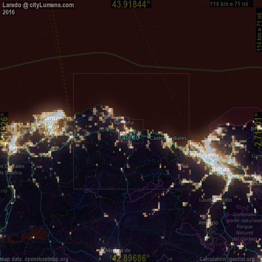
Analysis of Laredo night lights 2016
Square area 10x10 km:
 2.54%
2.54%90-99
2.54%80-89
3.02%70-79
5.4%60-69
3.33%50-59
3.49%40-49
0.32%30-39
5.08%20-29
5.87%10-19
32.86%0-9
35.56%Square area 50x50 km:
0.33%90-99
0.46%80-89
0.63%70-79
0.88%60-69
1.02%50-59
1.42%40-49
1.21%30-39
1.44%20-29
1.84%10-19
7.69%0-9
83.08%Clear (daylight) street map image can be seen on geolist.org.
Map coordinates:
43° 55' 6.4" North, 4° 7' 9.3" West
43° 24' 35.3" North, 3° 24' 58.1" West
42° 53' 48.7" North, 2° 42' 46.8" West
Some cities around Laredo sort by population:
• Santander
31.9 km =19.8 mi,  281°
281°
• Santurtzi
32.3 km =20.1 mi,  106°
106°
• Castro-Urdiales
16.1 km =10 mi,  100°
100°
• Santoña
5.1 km =3.2 mi,  318°
318°
• Zierbena
27.7 km =17.2 mi, 103°
• Ortuella
31.1 km =19.3 mi, 110°
• Zalla
30.1 km =18.7 mi,  130°
130°
• Colindres
3.4 km =2.1 mi,  244°
244°
3119145 (p: 12,591)
Sources (retrieved 2019-11-25):
» Earth at Night: Flat Maps 2012, 2016