Montmeló night lights from space
Night Light of Montmeló (Catalonia) from space (Spain) Src. Average luminocity for 10x10km area is 82.2925% and for 50x50km: 41.6758%.
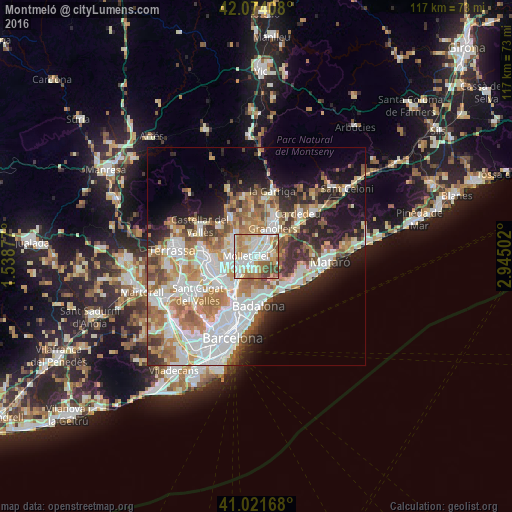
Analysis of Montmeló night lights 2016
Square area 10x10 km:
 21.94%
90-99
24.32%80-89
12.59%70-79
13.78%60-69
15.14%50-59
4.93%40-49
6.8%30-39
0.51%20-29
0%10-19
0%0-9
0%Square area 50x50 km:
10.52%90-99
9.57%80-89
4.15%70-79
5.36%60-69
7.5%50-59
5.15%40-49
3.75%30-39
3.81%20-29
6.83%10-19
10.34%0-9
33.02%Clear (daylight) street map image can be seen on geolist.org.
Map coordinates:
42° 4' 26.7" North, 1° 32' 19.6" East
41° 33' 0.1" North, 2° 14' 30.8" East
41° 1' 18" North, 2° 56' 42.1" East
Some cities around Montmeló sort by population:
• Granollers
7.5 km =4.7 mi,  30°
30°
• Mollet del Vallès
2.6 km =1.6 mi,  245°
245°
• Santa Perpètua de Mogoda
5.2 km =3.2 mi, 249°
• Parets del Vallès
2.9 km =1.8 mi,  345°
345°
• Montornès del Vallès
2.3 km =1.4 mi,  112°
112°
• Lliçà d'Amunt
7.4 km =4.6 mi, 354°
• La Llagosta
5.7 km =3.5 mi,  225°
225°
• Alella
7.6 km =4.7 mi,  144°
144°
3116276 (p: 8,717)
Sources (retrieved 2019-11-25):
» Earth at Night: Flat Maps 2012, 2016