Javea night lights from space
Night Light of Javea (Valencia) from space (Spain) Src. Average luminocity for 10x10km area is 23.7704% and for 50x50km: 9.3236%.
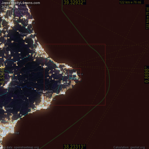
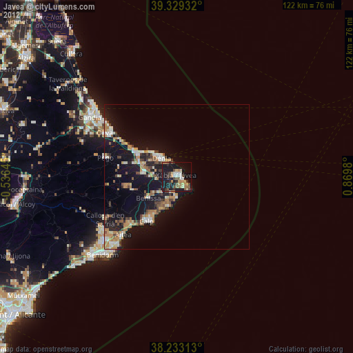
Analysis of Javea night lights 2016
Square area 10x10 km:
100  1.36%
1.36%
90-99 2.04%
80-89 3.4%
70-79 0.68%
60-69 3.23%
50-59 6.12%
40-49 1.19%
30-39 4.76%
20-29 5.61%
10-19 50.34%
0-9 21.26%
1.36%90-99
2.04%80-89
3.4%70-79
0.68%60-69
3.23%50-59
6.12%40-49
1.19%30-39
4.76%20-29
5.61%10-19
50.34%0-9
21.26%Square area 50x50 km:
100 0.87%
90-99 1.05%
80-89 1.16%
70-79 1%
60-69 1.14%
50-59 1.88%
40-49 0.97%
30-39 1.33%
20-29 2.27%
10-19 12.59%
0-9 75.74%
0.87%90-99
1.05%80-89
1.16%70-79
1%60-69
1.14%50-59
1.88%40-49
0.97%30-39
1.33%20-29
2.27%10-19
12.59%0-9
75.74%Clear (daylight) street map image can be seen on geolist.org.
Map coordinates:
39° 19' 45.6" North, 0° 32' 11.2" West
38° 46' 60" North, 0° 10' 0" East
38° 13' 59.3" North, 0° 52' 11.3" East
Some cities around Javea sort by population:
• Denia
8.3 km =5.2 mi,  320°
320°
• Calp
18.7 km =11.6 mi,  214°
214°
• Teulada
8.1 km =5 mi,  222°
222°
• Benissa
12.8 km =8 mi,  233°
233°
• Pego
25.5 km =15.8 mi,  285°
285°
• Pedreguer
11.5 km =7.1 mi,  275°
275°
• Ondara
13.9 km =8.6 mi, 291°
• Gata de Gorgos
7.1 km =4.4 mi,  262°
262°
2516336 (p: 31,593)
Sources (retrieved 2019-11-25):
» Earth at Night: Flat Maps 2012, 2016