Calp night lights from space
Night Light of Calp (Valencia) from space (Spain) Src. Average luminocity for 10x10km area is 25.6997% and for 50x50km: 11.531%.
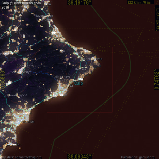
Analysis of Calp night lights 2016
Square area 10x10 km:
 3.57%
3.57%90-99
4.38%80-89
1.3%70-79
2.27%60-69
3.08%50-59
4.71%40-49
2.6%30-39
4.06%20-29
5.03%10-19
38.47%0-9
30.52%Square area 50x50 km:
1.4%90-99
1.6%80-89
1.44%70-79
1.23%60-69
1.41%50-59
1.97%40-49
1.11%30-39
1.62%20-29
3.31%10-19
12.71%0-9
72.2%Clear (daylight) street map image can be seen on geolist.org.
Map coordinates:
39° 11' 30.3" North, 0° 39' 31.1" West
38° 38' 40.9" North, 0° 2' 40.2" East
38° 5' 36.3" North, 0° 44' 51.4" East
Some cities around Calp sort by population:
• Javea
18.7 km =11.6 mi,  34°
34°
• Altea
9.8 km =6.1 mi,  238°
238°
• l'Alfàs del Pi
14.7 km =9.1 mi, 240°
• la Nucia
15.3 km =9.5 mi,  256°
256°
• Teulada
10.7 km =6.6 mi, 28°
• Benissa
7.8 km =4.8 mi,  2°
2°
• Pedreguer
16.5 km =10.3 mi,  356°
356°
• Gata de Gorgos
14.9 km =9.3 mi,  13°
13°
2520496 (p: 29,666)
Sources (retrieved 2019-11-25):
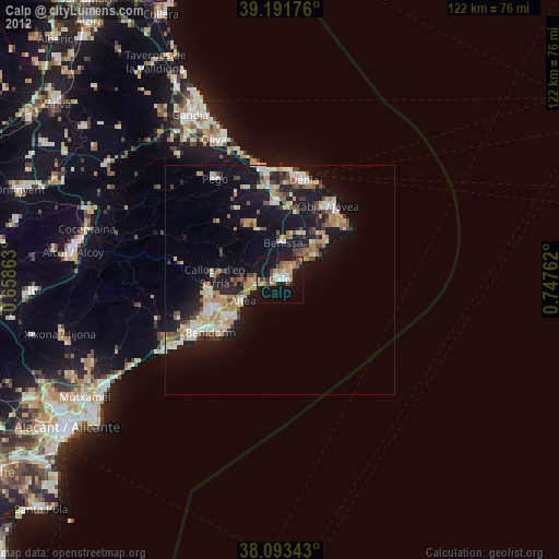
» Earth at Night: Flat Maps 2012, 2016