Elda night lights from space
Night Light of Elda (Valencia) from space (Spain) Src. Average luminocity for 10x10km area is 38.1964% and for 50x50km: 15.6702%.
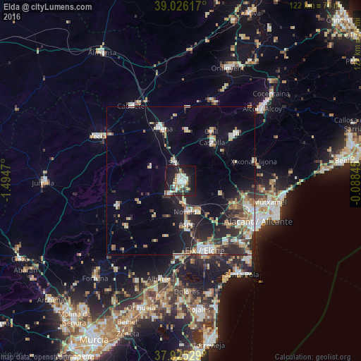
Analysis of Elda night lights 2016
Square area 10x10 km:
 7.47%
7.47%90-99
9.58%80-89
4.06%70-79
3.57%60-69
3.25%50-59
2.6%40-49
1.95%30-39
4.22%20-29
13.15%10-19
41.72%0-9
8.44%Square area 50x50 km:
2.04%90-99
2.78%80-89
1.99%70-79
1.52%60-69
1.78%50-59
1.69%40-49
1.81%30-39
2.33%20-29
5.31%10-19
10.35%0-9
68.4%Clear (daylight) street map image can be seen on geolist.org.
Map coordinates:
39° 1' 34.2" North, 1° 29' 40.9" West
38° 28' 40.2" North, 0° 47' 29.7" West
37° 55' 31" North, 0° 5' 18.4" West
Some cities around Elda sort by population:
• Villena
18.9 km =11.7 mi,  340°
340°
• Novelda
10.6 km =6.6 mi,  168°
168°
• Aspe
14.9 km =9.3 mi, 171°
• Monóvar
6.1 km =3.8 mi,  224°
224°
• Castalla
16.8 km =10.4 mi,  38°
38°
• Sax
7 km =4.3 mi, 340°
• Onil
19.4 km =12.1 mi,  32°
32°
• Monforte del Cid
12.2 km =7.6 mi,  153°
153°
2518505 (p: 55,168)
Sources (retrieved 2019-11-25):
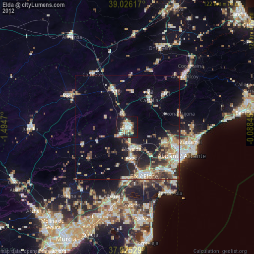
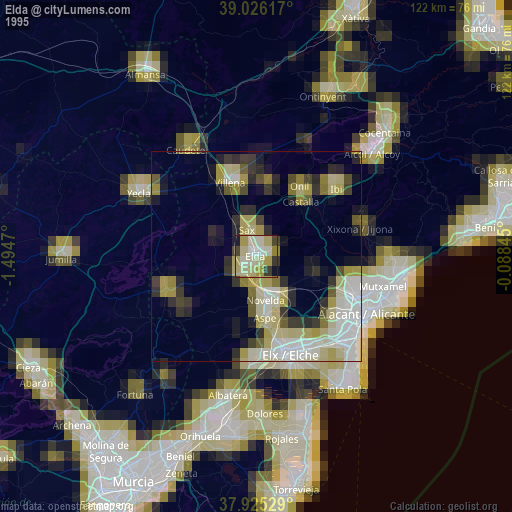
» NASA, Earths city lights 1995
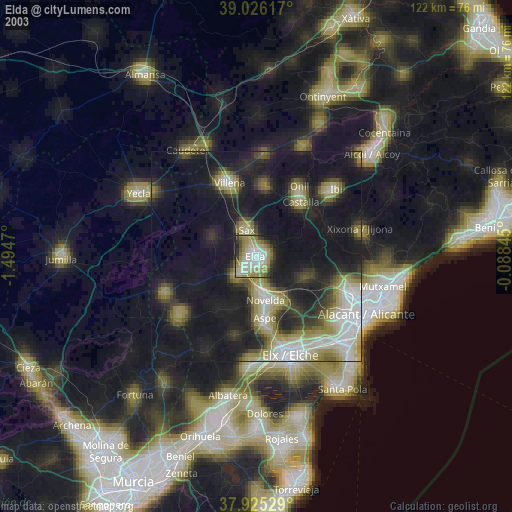
» NASA city lights 2003
» Earth at Night: Flat Maps 2012, 2016