Aspe night lights from space
Night Light of Aspe (Valencia) from space (Spain) Src. Average luminocity for 10x10km area is 32.8146% and for 50x50km: 22.3588%.
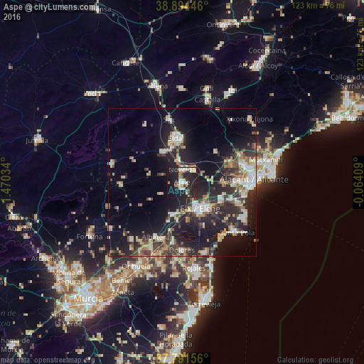
Analysis of Aspe night lights 2016
Square area 10x10 km:
 3.91%
3.91%90-99
5.78%80-89
4.08%70-79
3.91%60-69
3.57%50-59
2.89%40-49
2.04%30-39
3.4%20-29
15.99%10-19
43.88%0-9
10.54%Square area 50x50 km:
2.71%90-99
3.5%80-89
2.81%70-79
2.53%60-69
2.54%50-59
2.75%40-49
3.4%30-39
3.98%20-29
8.93%10-19
18.35%0-9
48.51%Clear (daylight) street map image can be seen on geolist.org.
Map coordinates:
38° 53' 40.1" North, 1° 28' 13.2" West
38° 20' 42.4" North, 0° 46' 2" West
37° 47' 29.6" North, 0° 3' 50.7" West
Some cities around Aspe sort by population:
• Elche
10.9 km =6.8 mi,  147°
147°
• Elda
14.9 km =9.3 mi,  351°
351°
• Crevillente
11.2 km =7 mi,  199°
199°
• Novelda
4.4 km =2.7 mi,  359°
359°
• Monóvar
12.2 km =7.6 mi,  328°
328°
• Albatera
20.6 km =12.8 mi,  206°
206°
• Catral
20.7 km =12.9 mi,  188°
188°
• Monforte del Cid
5.2 km =3.2 mi,  40°
40°
2521510 (p: 20,180)
Sources (retrieved 2019-11-25):
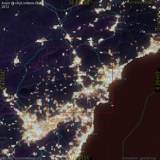
» Earth at Night: Flat Maps 2012, 2016