Elche night lights from space
Night Light of Elche (Valencia) from space (Spain) Src. Average luminocity for 10x10km area is 51.9898% and for 50x50km: 29.1839%.
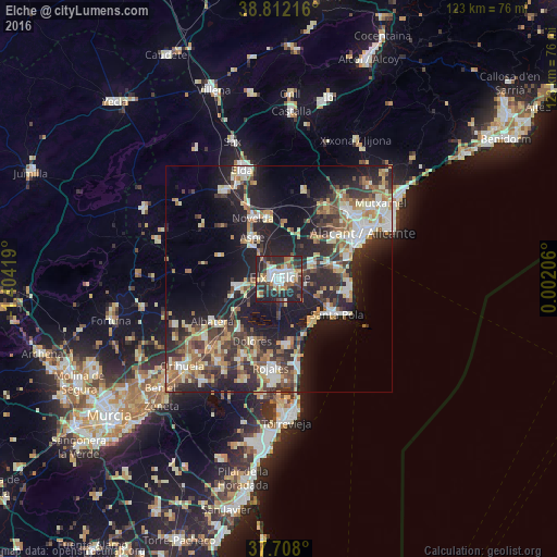
Analysis of Elche night lights 2016
Square area 10x10 km:
 10.03%
90-99
10.88%80-89
3.4%70-79
5.95%60-69
7.48%50-59
5.95%40-49
9.86%30-39
10.03%20-29
30.44%10-19
5.95%0-9
0%Square area 50x50 km:
3.87%90-99
4.88%80-89
3.81%70-79
3.51%60-69
3.82%50-59
3.91%40-49
4.58%30-39
5.63%20-29
11.15%10-19
18.82%0-9
36.02%Clear (daylight) street map image can be seen on geolist.org.
Map coordinates:
38° 48' 43.8" North, 1° 24' 15.1" West
38° 15' 43.8" North, 0° 42' 3.9" West
37° 42' 28.8" North, 0° 0' 7.4" East
Some cities around Elche sort by population:
• Santa Pola
14.2 km =8.8 mi,  123°
123°
• Crevillente
9.6 km =6 mi,  261°
261°
• Novelda
14.8 km =9.2 mi,  336°
336°
• Aspe
10.9 km =6.8 mi,  327°
327°
• Albatera
17.5 km =10.9 mi,  238°
238°
• Dolores
14.9 km =9.3 mi,  204°
204°
• Catral
14.3 km =8.9 mi,  218°
218°
• Monforte del Cid
13.3 km =8.3 mi,  349°
349°
2518559 (p: 230,112)
Sources (retrieved 2019-11-25):
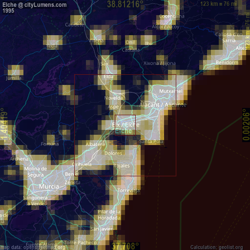
» NASA, Earths city lights 1995
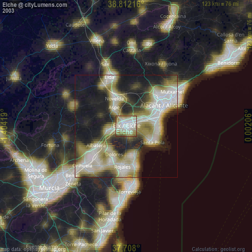
» NASA city lights 2003
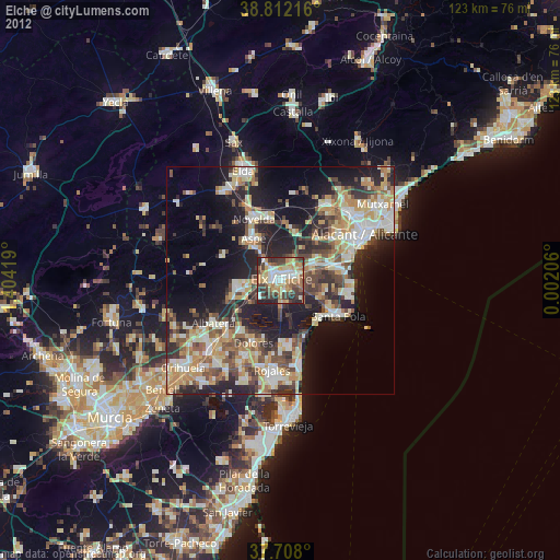
» Earth at Night: Flat Maps 2012, 2016