les Roquetes night lights from space
Night Light of les Roquetes (Catalonia) from space (Spain) Src. Average luminocity for 10x10km area is 88.9898% and for 50x50km: 46.3388%.
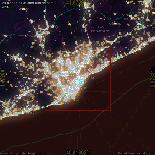
Analysis of les Roquetes night lights 2016
Square area 10x10 km:
 40.99%
90-99
24.49%80-89
3.06%70-79
12.93%60-69
16.84%50-59
1.7%40-49
0%30-39
0%20-29
0%10-19
0%0-9
0%Square area 50x50 km:
11.84%90-99
10.86%80-89
4.48%70-79
5.55%60-69
8.43%50-59
6.48%40-49
3.93%30-39
4.54%20-29
8.67%10-19
8.73%0-9
26.49%Clear (daylight) street map image can be seen on geolist.org.
Map coordinates:
41° 58' 22.7" North, 1° 28' 19.4" East
41° 26' 53.1" North, 2° 10' 30.7" East
40° 55' 8.1" North, 2° 52' 41.9" East
Some cities around les Roquetes sort by population:
• Nou Barris
0.7 km =0.4 mi,  166°
166°
• la Prosperitat
0.8 km =0.5 mi,  136°
136°
• Porta
1.5 km =0.9 mi, 168°
• la Guineueta
1.2 km =0.7 mi,  206°
206°
• Verdun
0.6 km =0.4 mi,  176°
176°
• la Trinitat Vella
1.5 km =0.9 mi,  74°
74°
• la Trinitat Nova
0.8 km =0.5 mi, 71°
• Canyelles
1 km =0.6 mi,  251°
251°
11549807 (p: 15,633)
Sources (retrieved 2019-11-25):
» Earth at Night: Flat Maps 2012, 2016