Arona night lights from space
Night Light of Arona (Canary Islands) from space (Spain) Src. Average luminocity for 10x10km area is 49.6818% and for 50x50km: 11.1988%.
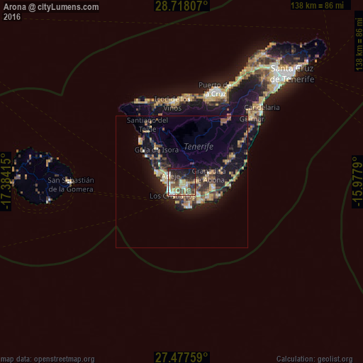
Analysis of Arona night lights 2016
Square area 10x10 km:
 5.68%
5.68%90-99
7.77%80-89
13.26%70-79
6.82%60-69
2.46%50-59
5.11%40-49
14.96%30-39
7.95%20-29
16.86%10-19
16.29%0-9
2.84%Square area 50x50 km:
0.88%90-99
1.06%80-89
2.12%70-79
1.73%60-69
1.12%50-59
1.38%40-49
2.07%30-39
2.16%20-29
3.29%10-19
8.99%0-9
75.2%Clear (daylight) street map image can be seen on geolist.org.
Map coordinates:
28° 43' 5.1" North, 17° 23' 2.9" West
28° 5' 58.6" North, 16° 40' 51.7" West
27° 28' 39.3" North, 15° 58' 40.4" West
Some cities around Arona sort by population:
• Adeje
5.1 km =3.2 mi,  300°
300°
• Granadilla de Abona
10.5 km =6.5 mi,  78°
78°
• Icod de los Vinos
30.5 km =19 mi,  354°
354°
• Guía de Isora
15.7 km =9.8 mi,  322°
322°
• San Isidro
12.3 km =7.6 mi,  102°
102°
• San Miguel De Abona
6.3 km =3.9 mi,  91°
91°
• Santiago del Teide
25.3 km =15.7 mi,  328°
328°
• Lomo de Arico
20.8 km =12.9 mi,  68°
68°
2521582 (p: 78,614)
Sources (retrieved 2019-11-25):
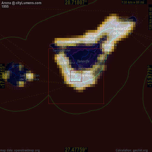
» NASA, Earths city lights 1995
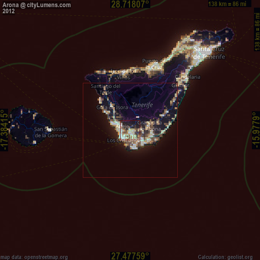
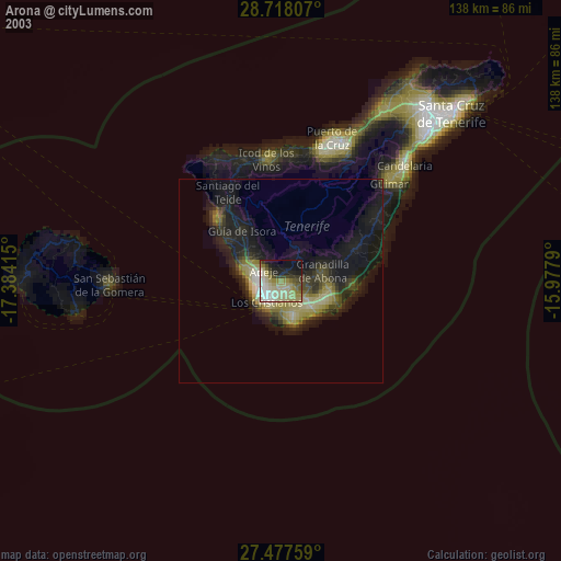
» NASA city lights 2003
» Earth at Night: Flat Maps 2012, 2016