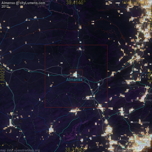
Almansa night lights from space
Night Light of Almansa (Castille-La Mancha) from space (Spain) Src. Average luminocity for 10x10km area is 9.3333% and for 50x50km: 1.6415%.
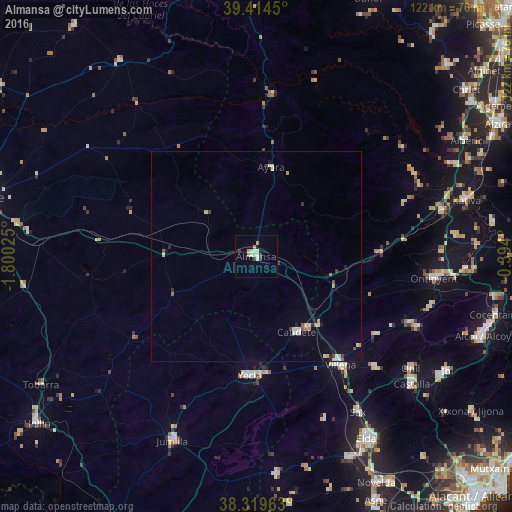
Analysis of Almansa night lights 2016
Square area 10x10 km:
 0.51%
0.51%90-99
3.4%80-89
0.85%70-79
1.7%60-69
1.02%50-59
0%40-49
0.68%30-39
1.02%20-29
1.02%10-19
0%0-9
89.8%Square area 50x50 km:
0.11%90-99
0.45%80-89
0.21%70-79
0.13%60-69
0.14%50-59
0.15%40-49
0.12%30-39
0.25%20-29
0.21%10-19
0.34%0-9
97.9%Clear (daylight) street map image can be seen on geolist.org.
Map coordinates:
39° 24' 52.2" North, 1° 48' 0.9" West
38° 52' 9" North, 1° 5' 49.7" West
38° 19' 10.7" North, 0° 23' 38.4" West
Some cities around Almansa sort by population:
• Ontinyent
42.9 km =26.7 mi,  97°
97°
• Villena
32.7 km =20.3 mi,  142°
142°
• Yecla
28.5 km =17.7 mi,  183°
183°
• Canals
45.6 km =28.3 mi,  76°
76°
• Caudete
20.4 km =12.7 mi,  152°
152°
• Sax
44.2 km =27.5 mi, 146°
• Ayora
21.3 km =13.2 mi,  9°
9°
• Enguera
37.6 km =23.4 mi,  70°
70°
2521923 (p: 25,727)
Sources (retrieved 2019-11-25):
» Earth at Night: Flat Maps 2012, 2016