Alcalà de Xivert night lights from space
Night Light of Alcalà de Xivert (Valencia) from space (Spain) Src. Average luminocity for 10x10km area is 2.3622% and for 50x50km: 5.0408%.
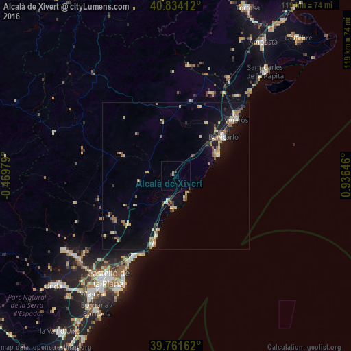
Analysis of Alcalà de Xivert night lights 2016
Square area 10x10 km:
 0%
0%90-99
0%80-89
0%70-79
1.02%60-69
0.34%50-59
0.34%40-49
0%30-39
0.68%20-29
0.68%10-19
0%0-9
96.94%Square area 50x50 km:
0.32%90-99
0.57%80-89
0.94%70-79
0.57%60-69
0.77%50-59
0.78%40-49
0.38%30-39
0.64%20-29
0.65%10-19
3.8%0-9
90.58%Clear (daylight) street map image can be seen on geolist.org.
Map coordinates:
40° 50' 2.8" North, 0° 28' 11.2" West
40° 18' 0" North, 0° 13' 60" East
39° 45' 41.8" North, 0° 56' 11.3" East
Some cities around Alcalà de Xivert sort by population:
• Vinaròs
27.9 km =17.3 mi,  47°
47°
• Benicarló
20.9 km =13 mi, 51°
• Benicàssim
31.2 km =19.4 mi,  206°
206°
• Oropesa del Mar
24.5 km =15.2 mi,  198°
198°
• Alcanar
34.2 km =21.3 mi,  37°
37°
• Ulldecona
37.7 km =23.4 mi,  28°
28°
• Peníscola
16 km =9.9 mi,  66°
66°
• Torreblanca
9.4 km =5.8 mi, 199°
3130619 (p: 6,615)
Sources (retrieved 2019-11-25):
» Earth at Night: Flat Maps 2012, 2016