Alcanar night lights from space
Night Light of Alcanar (Catalonia) from space (Spain) Src. Average luminocity for 10x10km area is 13.3847% and for 50x50km: 6.2621%.
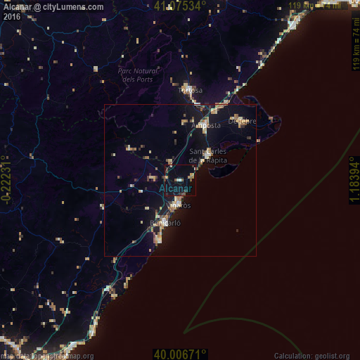
Analysis of Alcanar night lights 2016
Square area 10x10 km:
 0.32%
0.32%90-99
1.95%80-89
0.81%70-79
1.46%60-69
0.81%50-59
4.06%40-49
1.3%30-39
2.6%20-29
1.62%10-19
6.66%0-9
78.41%Square area 50x50 km:
0.4%90-99
0.7%80-89
0.93%70-79
0.84%60-69
0.9%50-59
0.98%40-49
0.57%30-39
0.71%20-29
0.85%10-19
5.88%0-9
87.23%Clear (daylight) street map image can be seen on geolist.org.
Map coordinates:
41° 4' 31.2" North, 0° 13' 20.3" West
40° 32' 35.4" North, 0° 28' 51" East
40° 0' 24.2" North, 1° 11' 2.2" East
Some cities around Alcanar sort by population:
• Tortosa
30.1 km =18.7 mi,  6°
6°
• Vinaròs
8.1 km =5 mi,  183°
183°
• Benicarló
14.8 km =9.2 mi,  197°
197°
• Amposta
20.3 km =12.6 mi,  23°
23°
• Sant Carles de la Ràpita
13 km =8.1 mi,  50°
50°
• Deltebre
27.4 km =17 mi,  44°
44°
• Ulldecona
6.7 km =4.2 mi,  334°
334°
• Peníscola
21.6 km =13.4 mi, 196°
3130608 (p: 10,570)
Sources (retrieved 2019-11-25):
» Earth at Night: Flat Maps 2012, 2016