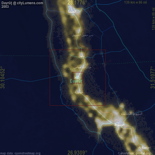
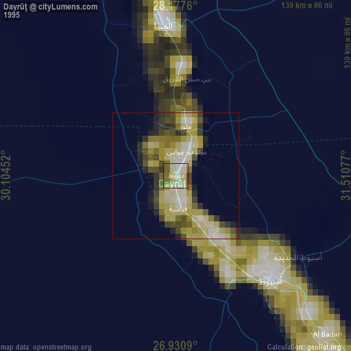
Dayrūţ night lights from space
Night Light of Dayrūţ (Asyut) from space (Egypt) Src. Average luminocity for 10x10km area is 74.1984% and for 50x50km: 28.7449%.


Analysis of Dayrūţ night lights 2016
Square area 10x10 km:
 12.7%
12.7%90-99
24.8%80-89
9.33%70-79
6.75%60-69
11.31%50-59
18.06%40-49
16.07%30-39
0.99%20-29
0%10-19
0%0-9
0%Square area 50x50 km:
2.94%90-99
5.34%80-89
3.83%70-79
4.04%60-69
4.93%50-59
7.27%40-49
7.97%30-39
3.08%20-29
4.33%10-19
8.13%0-9
48.14%Clear (daylight) street map image can be seen on geolist.org.
Map coordinates:
28° 10' 39.4" North, 30° 6' 16.3" East
27° 33' 21.7" North, 30° 48' 27.5" East
26° 55' 51.2" North, 31° 30' 38.8" East
Some cities around Dayrūţ sort by population:
• Asyūţ
55.8 km =34.7 mi,  138°
138°
• Al Minyā
61.8 km =38.4 mi,  354°
354°
• Mallawī
19.8 km =12.3 mi,  9°
9°
• Manfalūţ
31.7 km =19.7 mi,  149°
149°
• Abnūb
46.5 km =28.9 mi,  133°
133°
• Al Qūşīyah
12.9 km =8 mi,  175°
175°
• Abū Qurqāş
41.8 km =26 mi,  4°
4°
• Dayr Mawās
10.3 km =6.4 mi,  21°
21°
358269 (p: 67,788)
Sources (retrieved 2019-11-25):
» NASA, Earths city lights 1995
» NASA city lights 2003
» Earth at Night: Flat Maps 2012, 2016