Dayr Mawās night lights from space
Night Light of Dayr Mawās (Minya) from space (Egypt) Src. Average luminocity for 10x10km area is 68.8075% and for 50x50km: 26.5511%.
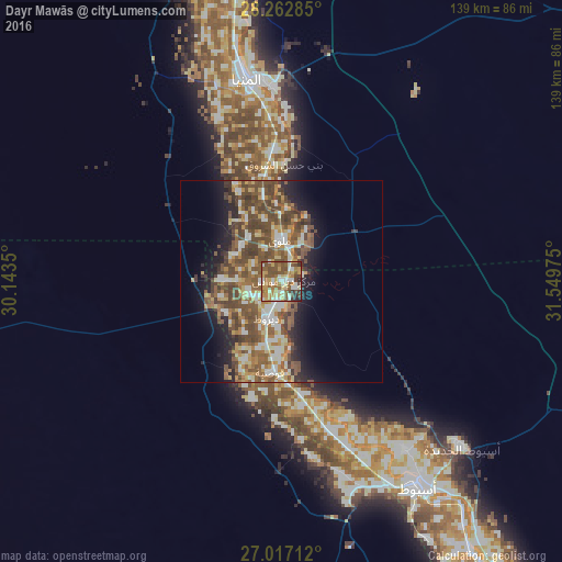
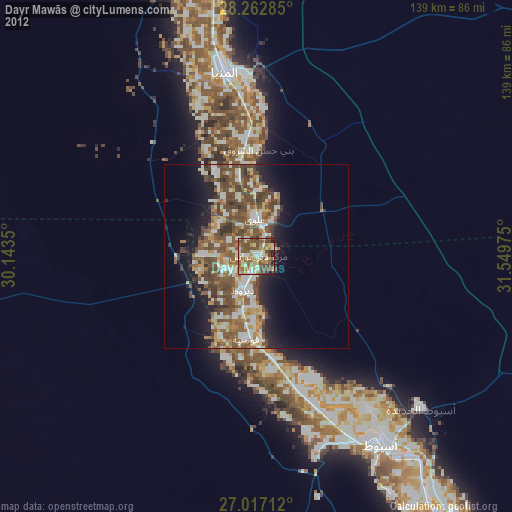
Analysis of Dayr Mawās night lights 2016
Square area 10x10 km:
 5.75%
5.75%90-99
16.87%80-89
12.7%70-79
14.09%60-69
11.51%50-59
20.44%40-49
10.12%30-39
5.75%20-29
2.78%10-19
0%0-9
0%Square area 50x50 km:
2.77%90-99
4.53%80-89
3.21%70-79
3.79%60-69
4.28%50-59
6.9%40-49
8.66%30-39
3.09%20-29
3.54%10-19
7.78%0-9
51.43%Clear (daylight) street map image can be seen on geolist.org.
Map coordinates:
28° 15' 46.3" North, 30° 8' 36.6" East
27° 38' 30.3" North, 30° 50' 47.8" East
27° 1' 1.6" North, 31° 32' 59.1" East
Some cities around Dayr Mawās sort by population:
• Asyūţ
61.1 km =38 mi,  147°
147°
• Al Minyā
52.9 km =32.9 mi,  349°
349°
• Mallawī
10 km =6.2 mi,  357°
357°
• Manfalūţ
38.8 km =24.1 mi,  161°
161°
• Abnūb
51.1 km =31.8 mi,  144°
144°
• Al Qūşīyah
22.6 km =14 mi,  187°
187°
• Dayrūţ
10.3 km =6.4 mi,  201°
201°
• Abū Qurqāş
32.2 km =20 mi, 358°
358274 (p: 40,609)
Sources (retrieved 2019-11-25):
» Earth at Night: Flat Maps 2012, 2016