Kiviõli night lights from space
Night Light of Kiviõli (Ida-Virumaa) from space (Estonia) Src. Average luminocity for 10x10km area is 11.2522% and for 50x50km: 2.2521%.
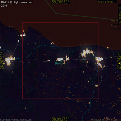
Analysis of Kiviõli night lights 2016
Square area 10x10 km:
 2.06%
2.06%90-99
3.14%80-89
0.54%70-79
1.19%60-69
1.52%50-59
1.3%40-49
0%30-39
0%20-29
0%10-19
0.32%0-9
89.94%Square area 50x50 km:
0.39%90-99
0.41%80-89
0.15%70-79
0.27%60-69
0.4%50-59
0.26%40-49
0.14%30-39
0.02%20-29
0.02%10-19
1.93%0-9
96.01%Clear (daylight) street map image can be seen on geolist.org.
Map coordinates:
59° 42' 34.5" North, 26° 16' 4.8" East
59° 21' 11" North, 26° 58' 16" East
58° 59' 33.9" North, 27° 40' 27.3" East
Some cities around Kiviõli sort by population:
• Narva
69.1 km =42.9 mi,  87°
87°
• Kohtla-Järve
17.8 km =11.1 mi,  73°
73°
• Slantsy, RU
68.9 km =42.8 mi,  112°
112°
• Rakvere
34.9 km =21.7 mi,  268°
268°
• Sillamäe
45.1 km =28 mi,  83°
83°
• Jõhvi
25.5 km =15.8 mi, 88°
• Ivangorod, RU
70.6 km =43.9 mi, 88°
• Tapa
58.4 km =36.3 mi,  259°
259°
591313 (p: 6,953)
Sources (retrieved 2019-11-25):
» Earth at Night: Flat Maps 2012, 2016