Valdez night lights from space
Night Light of Valdez (Esmeraldas) from space (Ecuador) Src. Average luminocity for 10x10km area is 4.0022% and for 50x50km: 1.2291%.
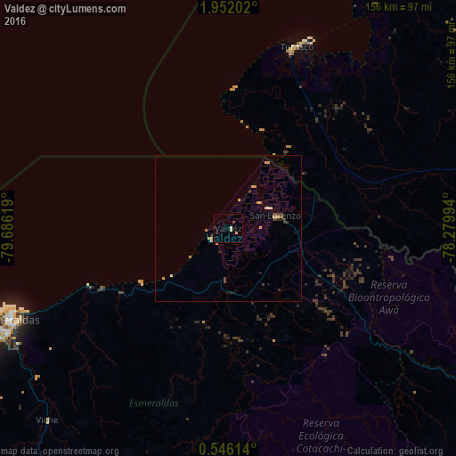
Analysis of Valdez night lights 2016
Square area 10x10 km:
 0%
0%90-99
0.87%80-89
1.73%70-79
0%60-69
0%50-59
0%40-49
0.87%30-39
0.87%20-29
0.87%10-19
0%0-9
94.81%Square area 50x50 km:
0%90-99
0.11%80-89
0.24%70-79
0.48%60-69
0.03%50-59
0.03%40-49
0.24%30-39
0.32%20-29
0.19%10-19
0.24%0-9
98.1%Clear (daylight) street map image can be seen on geolist.org.
Map coordinates:
1° 57' 7.3" North, 79° 41' 10.3" West
1° 14' 57" North, 78° 58' 59" West
0° 32' 46.1" North, 78° 16' 47.8" West
Some cities around Valdez sort by population:
• Esmeraldas
81.3 km =50.5 mi,  246°
246°
• Tumaco, CO
63.9 km =39.7 mi,  19°
19°
• Rosa Zarate
116.1 km =72.1 mi,  208°
208°
• San Lorenzo de Esmeraldas
17 km =10.6 mi,  75°
75°
• Atuntaqui
133.1 km =82.7 mi,  139°
139°
• Cotacachi
132.3 km =82.2 mi, 142°
• Barbacoas, CO
104.8 km =65.1 mi,  63°
63°
• Salahonda, CO
95.1 km =59.1 mi, 22°
3650312 (p: 11,441)
Sources (retrieved 2019-11-25):
» Earth at Night: Flat Maps 2012, 2016