Cuenca night lights from space
Night Light of Cuenca (Azuay) from space (Ecuador) Src. Average luminocity for 10x10km area is 91.9048% and for 50x50km: 22.8087%.
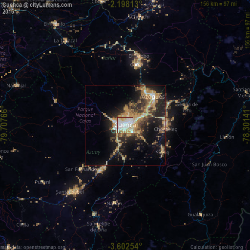
Analysis of Cuenca night lights 2016
Square area 10x10 km:
 33.55%
90-99
35.71%80-89
13.2%70-79
11.9%60-69
4.55%50-59
0%40-49
1.08%30-39
0%20-29
0%10-19
0%0-9
0%Square area 50x50 km:
2.15%90-99
2.76%80-89
3.76%70-79
4.56%60-69
3.37%50-59
2.74%40-49
3.73%30-39
4.76%20-29
7.14%10-19
12.09%0-9
52.94%Clear (daylight) street map image can be seen on geolist.org.
Map coordinates:
2° 11' 53.3" South, 79° 42' 27.6" West
2° 54' 2" South, 79° 0' 16.3" West
3° 36' 9.1" South, 78° 18' 5.1" West
Some cities around Cuenca sort by population:
• La Troncal
64.8 km =40.3 mi,  324°
324°
• Azogues
24.9 km =15.5 mi,  44°
44°
• Naranjal
72.7 km =45.2 mi,  290°
290°
• Gualaceo
25.2 km =15.7 mi,  87°
87°
• Alausí
79.5 km =49.4 mi,  12°
12°
• Baláo
89.9 km =55.9 mi,  269°
269°
• Cañar
38.5 km =23.9 mi, 10°
• Coronel Marcelino Maridueña
90.4 km =56.2 mi,  328°
328°
3658666 (p: 276,964)
Sources (retrieved 2019-11-25):
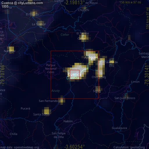
» NASA, Earths city lights 1995
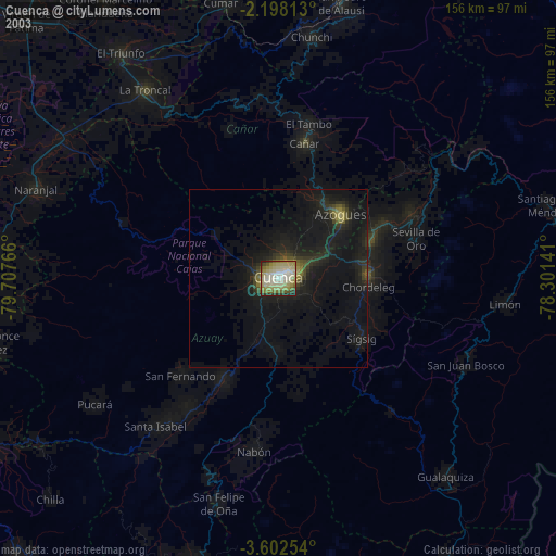
» NASA city lights 2003
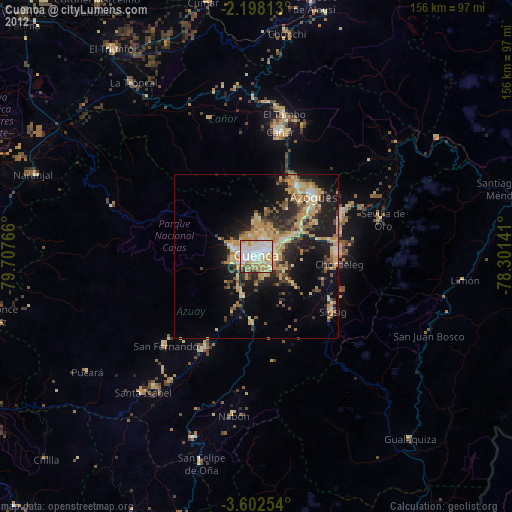
» Earth at Night: Flat Maps 2012, 2016