Azogues night lights from space
Night Light of Azogues (Cañar) from space (Ecuador) Src. Average luminocity for 10x10km area is 61.526% and for 50x50km: 22.4015%.
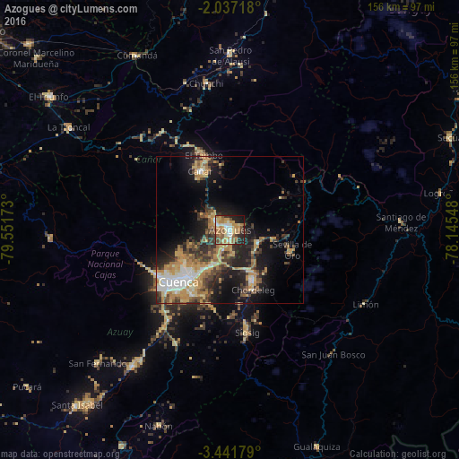
Analysis of Azogues night lights 2016
Square area 10x10 km:
 6.71%
6.71%90-99
9.09%80-89
12.99%70-79
16.45%60-69
14.07%50-59
9.96%40-49
5.41%30-39
4.33%20-29
13.42%10-19
7.36%0-9
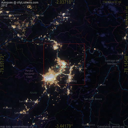
0.22%Square area 50x50 km:
2.32%90-99
2.8%80-89
3.26%70-79
4.91%60-69
3.77%50-59
2.77%40-49
3.53%30-39
4.65%20-29
5.6%10-19
11.46%0-9
54.94%Clear (daylight) street map image can be seen on geolist.org.
Map coordinates:
2° 2' 13.8" South, 79° 33' 6.2" West
2° 44' 22.9" South, 78° 50' 55" West
3° 26' 30.4" South, 78° 8' 43.7" West
Some cities around Azogues sort by population:
• Cuenca
24.9 km =15.5 mi,  224°
224°
• La Troncal
64.9 km =40.3 mi,  302°
302°
• Naranjal
85.8 km =53.3 mi,  274°
274°
• Gualaceo
18.7 km =11.6 mi,  155°
155°
• Alausí
59.6 km =37 mi,  0°
0°
• Cañar
22.3 km =13.9 mi,  333°
333°
• Sucúa
81.4 km =50.6 mi,  67°
67°
• Coronel Marcelino Maridueña
87.7 km =54.5 mi,  312°
312°
3660434 (p: 34,877)
Sources (retrieved 2019-11-25):
» Earth at Night: Flat Maps 2012, 2016