Tizi Ouzou night lights from space
Night Light of Tizi Ouzou from space (Algeria) Src. Average luminocity for 10x10km area is 58.3773% and for 50x50km: 19.1434%.
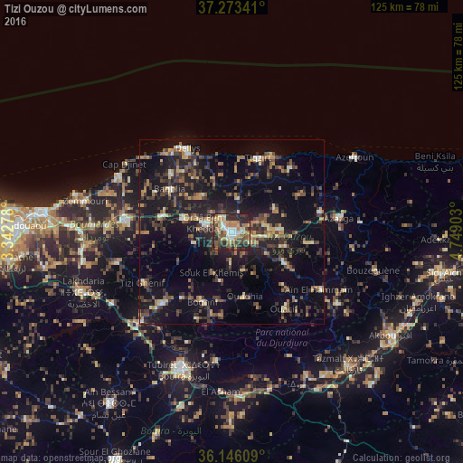
Analysis of Tizi Ouzou night lights 2016
Square area 10x10 km:
 7.88%
7.88%90-99
10.44%80-89
8.61%70-79
8.97%60-69
12.45%50-59
8.79%40-49
11.36%30-39
7.69%20-29
23.44%10-19
0.37%0-9
0%Square area 50x50 km:
0.66%90-99
2.03%80-89
1.63%70-79
2.4%60-69
2.91%50-59
2.72%40-49
3.99%30-39
5.58%20-29
6.66%10-19
18.41%0-9
53.01%Clear (daylight) street map image can be seen on geolist.org.
Map coordinates:
37° 16' 24.3" North, 3° 20' 34" East
36° 42' 42.6" North, 4° 2' 45.3" East
36° 8' 45.9" North, 4° 44' 56.5" East
Some cities around Tizi Ouzou sort by population:
• Draa Ben Khedda
7.9 km =4.9 mi,  288°
288°
• Makouda
8.3 km =5.2 mi,  10°
10°
• Beni Douala
10.8 km =6.7 mi,  162°
162°
• L’Arbaa Naït Irathen
16.3 km =10.1 mi,  123°
123°
• Tirmitine
8.6 km =5.3 mi,  221°
221°
• Tadmaït
13.5 km =8.4 mi, 285°
• Boudjima
13.8 km =8.6 mi,  43°
43°
• Naciria
19.5 km =12.1 mi,  281°
281°
2475744 (p: 144,000)
Sources (retrieved 2019-11-25):
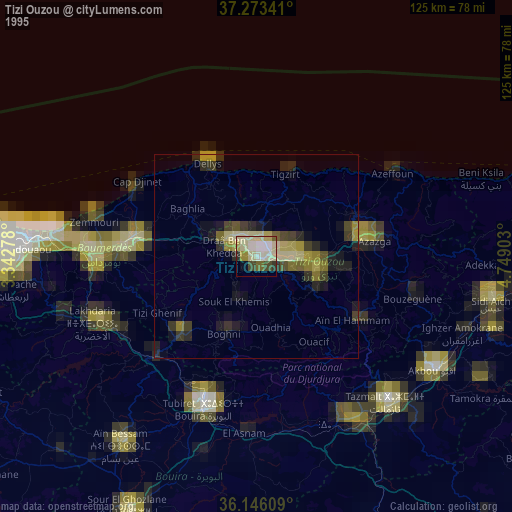
» NASA, Earths city lights 1995
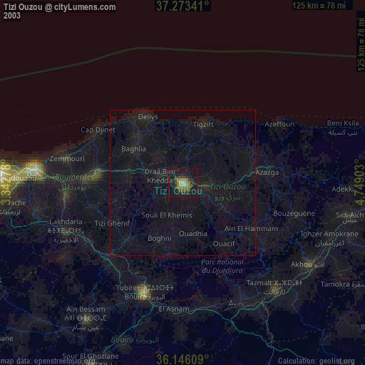
» NASA city lights 2003
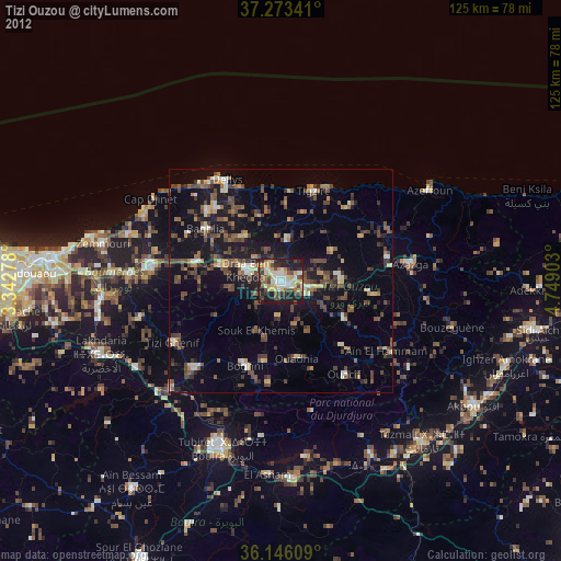
» Earth at Night: Flat Maps 2012, 2016