Beni Douala night lights from space
Night Light of Beni Douala (Tizi Ouzou) from space (Algeria) Src. Average luminocity for 10x10km area is 15.2363% and for 50x50km: 16.5187%.
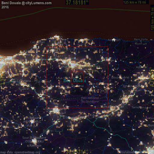
Analysis of Beni Douala night lights 2016
Square area 10x10 km:
 0%
0%90-99
0.73%80-89
1.47%70-79
1.65%60-69
1.28%50-59
1.47%40-49
3.66%30-39
4.4%20-29
4.95%10-19
27.11%0-9
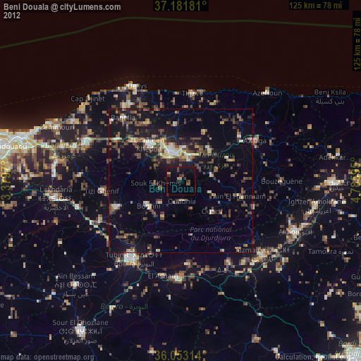
53.3%Square area 50x50 km:
0.57%90-99
1.61%80-89
1.49%70-79
1.86%60-69
2.27%50-59
2.34%40-49
3.4%30-39
4.95%20-29
5.77%10-19
15.81%0-9
59.92%Clear (daylight) street map image can be seen on geolist.org.
Map coordinates:
37° 10' 54.5" North, 3° 22' 46.9" East
36° 37' 10.3" North, 4° 4' 58.2" East
36° 3' 11.3" North, 4° 47' 9.4" East
Some cities around Beni Douala sort by population:
• Tizi Ouzou
10.8 km =6.7 mi,  342°
342°
• Boghni
14.4 km =8.9 mi,  233°
233°
• Draa Ben Khedda
16.7 km =10.4 mi,  319°
319°
• L’Arbaa Naït Irathen
10.4 km =6.5 mi,  82°
82°
• Mekla
17.6 km =10.9 mi,  66°
66°
• Tirmitine
9.8 km =6.1 mi,  292°
292°
• Tizi-n-Tleta
8.5 km =5.3 mi,  195°
195°
• Tizi Rached
11.3 km =7 mi,  59°
59°
2504703 (p: 33,611)
Sources (retrieved 2019-11-25):
» Earth at Night: Flat Maps 2012, 2016