Oran night lights from space
Night Light of Oran from space (Algeria) Src. Average luminocity for 10x10km area is 80.6031% and for 50x50km: 20.4937%.
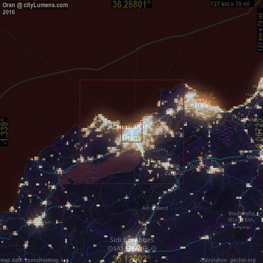
Analysis of Oran night lights 2016
Square area 10x10 km:
 36.36%
90-99
20.63%80-89
5.94%70-79
8.74%60-69
9.27%50-59
1.75%40-49
3.15%30-39
6.29%20-29
7.87%10-19
0%0-9
0%Square area 50x50 km:
3.3%90-99
3.19%80-89
2.65%70-79
2.44%60-69
3.34%50-59
1.89%40-49
2.6%30-39
3.63%20-29
5.77%10-19
13.85%0-9
57.35%Clear (daylight) street map image can be seen on geolist.org.
Map coordinates:
36° 16' 4.8" North, 1° 20' 20.4" West
35° 41' 56.6" North, 0° 38' 9.2" West
35° 7' 33.7" North, 0° 4' 2.1" East
Some cities around Oran sort by population:
• Es Senia
5.8 km =3.6 mi,  169°
169°
• Bir el Djir
8.5 km =5.3 mi,  74°
74°
• ’Aïn el Turk
13 km =8.1 mi,  292°
292°
• Aïn el Bya
32.3 km =20.1 mi, 68°
• Sidi ech Chahmi
11.2 km =7 mi,  113°
113°
• Bou Tlelis
27.7 km =17.2 mi,  239°
239°
• Mers el Kebir
7.3 km =4.5 mi,  296°
296°
• ’Aïn el Berd
38.9 km =24.2 mi,  163°
163°
2485926 (p: 645,984)
Sources (retrieved 2019-11-25):
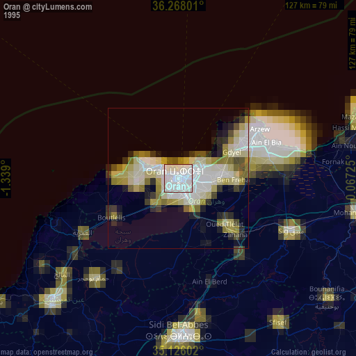
» NASA, Earths city lights 1995
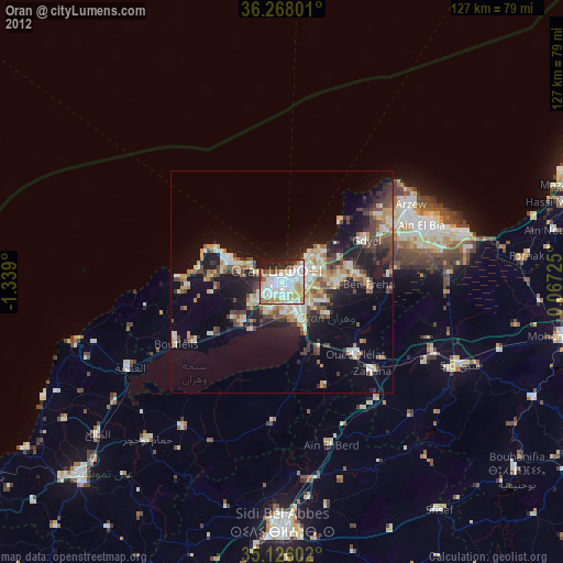
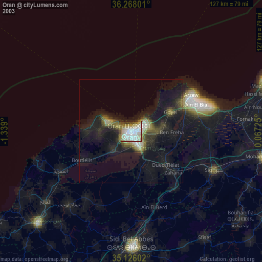
» NASA city lights 2003
» Earth at Night: Flat Maps 2012, 2016