La Julia night lights from space
Night Light of La Julia (Nacional) from space (Dominican Republic) Src. Average luminocity for 10x10km area is 84.719% and for 50x50km: 26.3375%.
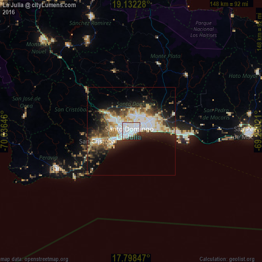
Analysis of La Julia night lights 2016
Square area 10x10 km:
 50.62%
90-99
23.76%80-89
2.48%70-79
1.65%60-69
2.48%50-59
0%40-49
2.69%30-39
7.02%20-29
7.64%10-19
1.65%0-9
0%Square area 50x50 km:
6.01%90-99
5.84%80-89
2.86%70-79
2.81%60-69
3.82%50-59
1.89%40-49
3.38%30-39
4.75%20-29
6.46%10-19
9.58%0-9
52.61%Clear (daylight) street map image can be seen on geolist.org.
Map coordinates:
19° 7' 56.2" North, 70° 38' 11.3" West
18° 28' 0" North, 69° 55' 60" West
17° 47' 54.5" North, 69° 13' 48.8" West
Some cities around La Julia sort by population:
• Santo Domingo
4.4 km =2.7 mi,  82°
82°
• Bella Vista
1.8 km =1.1 mi,  225°
225°
• Villa Francisca
5 km =3.1 mi,  68°
68°
• Villa Consuelo
4 km =2.5 mi,  62°
62°
• Ciudad Nueva
4.2 km =2.6 mi,  89°
89°
• Cristo Rey
3.7 km =2.3 mi,  0°
0°
• San Carlos
4 km =2.5 mi, 62°
• La Agustina
3.7 km =2.3 mi, 0°
3502052 (p: 12,575)
Sources (retrieved 2019-11-25):
» Earth at Night: Flat Maps 2012, 2016