Las Terrenas night lights from space
Night Light of Las Terrenas (Samaná) from space (Dominican Republic) Src. Average luminocity for 10x10km area is 7.3074% and for 50x50km: 0.8023%.
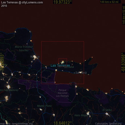
Analysis of Las Terrenas night lights 2016
Square area 10x10 km:
 0%
0%90-99
0.65%80-89
0.65%70-79
1.3%60-69
4.11%50-59
1.08%40-49
0%30-39
0.87%20-29
1.52%10-19
1.08%0-9
88.74%Square area 50x50 km:
0.04%90-99
0.05%80-89
0.09%70-79
0.19%60-69
0.28%50-59
0.1%40-49
0.09%30-39
0.14%20-29
0.15%10-19
0.1%0-9
98.78%Clear (daylight) street map image can be seen on geolist.org.
Map coordinates:
19° 58' 23.6" North, 70° 14' 45.3" West
19° 18' 39.7" North, 69° 32' 34.1" West
18° 38' 46" North, 68° 50' 22.8" West
Some cities around Las Terrenas sort by population:
• Nagua
32.9 km =20.4 mi,  284°
284°
• Sabana Grande de Boyá
48.5 km =30.1 mi,  212°
212°
• Sabana de la Mar
32.3 km =20.1 mi,  149°
149°
• Samaná
24.6 km =15.3 mi,  118°
118°
• Sánchez
11.8 km =7.3 mi,  218°
218°
• El Factor
36.3 km =22.6 mi,  271°
271°
• Villa Riva
41.5 km =25.8 mi,  249°
249°
• El Valle
41.1 km =25.5 mi,  155°
155°
3500243 (p: 7,713)
Sources (retrieved 2019-11-25):
» Earth at Night: Flat Maps 2012, 2016