Enriquillo night lights from space
Night Light of Enriquillo (Barahona) from space (Dominican Republic) Src. Average luminocity for 10x10km area is 2.0758% and for 50x50km: 0.2521%.
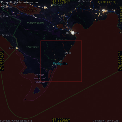
Analysis of Enriquillo night lights 2016
Square area 10x10 km:
 0%
0%90-99
0.87%80-89
0%70-79
0%60-69
0%50-59
0%40-49
0%30-39
2.6%20-29
0%10-19
0%0-9
96.54%Square area 50x50 km:
0%90-99
0.03%80-89
0.03%70-79
0.07%60-69
0%50-59
0.07%40-49
0.03%30-39
0.13%20-29
0.07%10-19
0%0-9
99.57%Clear (daylight) street map image can be seen on geolist.org.
Map coordinates:
18° 34' 4.1" North, 71° 56' 11.3" West
17° 54' 0" North, 71° 13' 60" West
17° 13' 46.8" North, 70° 31' 48.8" West
Some cities around Enriquillo sort by population:
• Santa Cruz de Barahona
37.1 km =23.1 mi,  22°
22°
• Neiba
67.6 km =42 mi,  343°
343°
• Duvergé
61.5 km =38.2 mi,  329°
329°
• Cabral
39 km =24.2 mi,  2°
2°
• Pedernales
56.2 km =34.9 mi,  285°
285°
• Vicente Noble
54.2 km =33.7 mi,  5°
5°
• Paraíso
12.5 km =7.8 mi,  35°
35°
• Tamayo
55.1 km =34.2 mi, 3°
3505947 (p: 5,423)
Sources (retrieved 2019-11-25):
» Earth at Night: Flat Maps 2012, 2016