Cabral night lights from space
Night Light of Cabral (Barahona) from space (Dominican Republic) Src. Average luminocity for 10x10km area is 1.8203% and for 50x50km: 1.5382%.
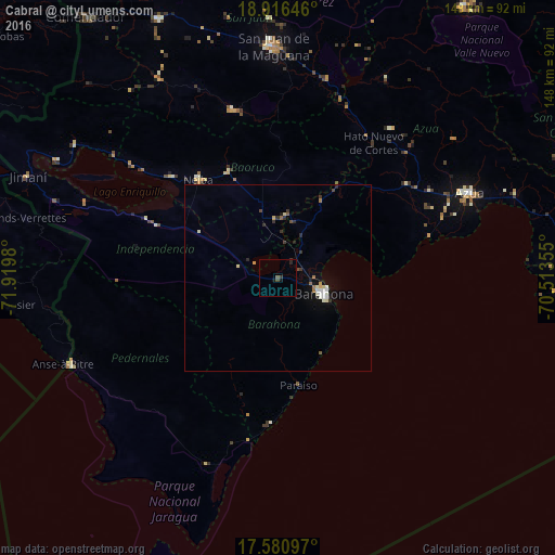
Analysis of Cabral night lights 2016
Square area 10x10 km:
 0%
0%90-99
0%80-89
0%70-79
0%60-69
0%50-59
0%40-49
1.73%30-39
0.87%20-29
1.08%10-19
1.95%0-9
94.37%Square area 50x50 km:
0.17%90-99
0.3%80-89
0.17%70-79
0.1%60-69
0.17%50-59
0.12%40-49
0.19%30-39
0.34%20-29
0.29%10-19
0.87%0-9
97.28%Clear (daylight) street map image can be seen on geolist.org.
Map coordinates:
18° 54' 59.3" North, 71° 55' 11.3" West
18° 15' 0" North, 71° 13' 0" West
17° 34' 51.5" North, 70° 30' 48.8" West
Some cities around Cabral sort by population:
• Santa Cruz de Barahona
13.1 km =8.1 mi,  110°
110°
• Neiba
33.5 km =20.8 mi,  320°
320°
• Duvergé
35.5 km =22.1 mi,  293°
293°
• Vicente Noble
15.4 km =9.6 mi,  14°
14°
• Villa Jaragua
38.9 km =24.2 mi,  313°
313°
• Paraíso
29.2 km =18.1 mi,  169°
169°
• Tamayo
16.2 km =10.1 mi, 5°
• Galván
31 km =19.3 mi,  334°
334°
3510885 (p: 12,303)
Sources (retrieved 2019-11-25):
» Earth at Night: Flat Maps 2012, 2016