Azua night lights from space
Night Light of Azua from space (Dominican Republic) Src. Average luminocity for 10x10km area is 22.6674% and for 50x50km: 2.2517%.
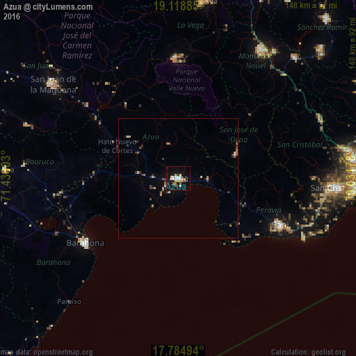
Analysis of Azua night lights 2016
Square area 10x10 km:
 2.27%
2.27%90-99
5.17%80-89
2.69%70-79
2.27%60-69
3.93%50-59
1.86%40-49
1.65%30-39
2.48%20-29
1.45%10-19
24.59%0-9
51.65%Square area 50x50 km:
0.11%90-99
0.35%80-89
0.29%70-79
0.19%60-69
0.53%50-59
0.15%40-49
0.29%30-39
0.53%20-29
0.48%10-19
1.17%0-9
95.91%Clear (daylight) street map image can be seen on geolist.org.
Map coordinates:
19° 7' 7.9" North, 71° 26' 16.9" West
18° 27' 11.5" North, 70° 44' 5.6" West
17° 47' 5.8" North, 70° 1' 54.4" West
Some cities around Azua sort by population:
• Santa Cruz de Barahona
47.2 km =29.3 mi,  234°
234°
• Baní
46.7 km =29 mi,  114°
114°
• San José de Ocoa
26.2 km =16.3 mi,  66°
66°
• Sabana Yegua
41.7 km =25.9 mi,  314°
314°
• Padre Las Casas
37.7 km =23.4 mi,  325°
325°
• Peralta
14.8 km =9.2 mi,  345°
345°
• Yayas de Viajama
26.6 km =16.5 mi, 310°
• Estebanía
9.7 km =6 mi,  87°
87°
3512208 (p: 59,139)
Sources (retrieved 2019-11-25):
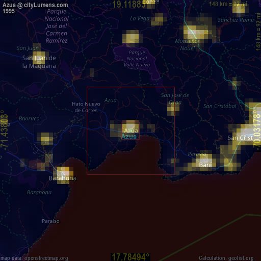
» NASA, Earths city lights 1995
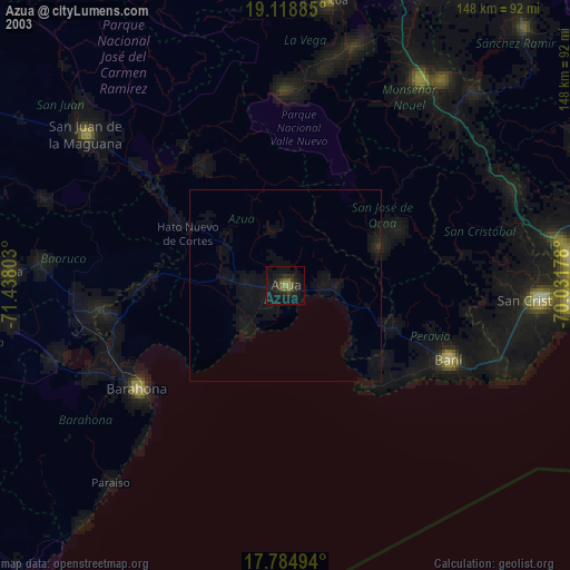
» NASA city lights 2003
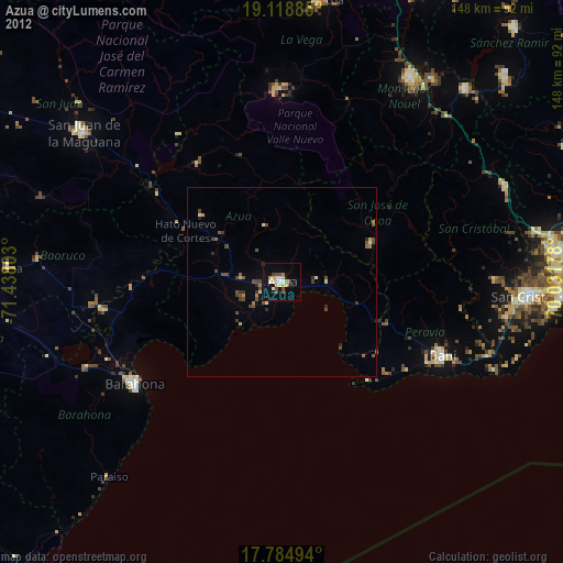
» Earth at Night: Flat Maps 2012, 2016