Vallensbæk night lights from space
Night Light of Vallensbæk (Capital Region) from space (Denmark) Src. Average luminocity for 10x10km area is 65.9524% and for 50x50km: 21.4168%.
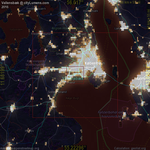
Analysis of Vallensbæk night lights 2016
Square area 10x10 km:
 20.8%
20.8%90-99
21.68%80-89
5.64%70-79
4.51%60-69
6.02%50-59
4.26%40-49
5.01%30-39
6.77%20-29
15.54%10-19
9.77%0-9
0%Square area 50x50 km:
5.66%90-99
5.19%80-89
2.12%70-79
1.75%60-69
1.87%50-59
1.74%40-49
2.02%30-39
2.28%20-29
5.1%10-19
11.31%0-9
60.96%Clear (daylight) street map image can be seen on geolist.org.
Map coordinates:
56° 1' 1.2" North, 11° 40' 55.2" East
55° 37' 19.2" North, 12° 23' 6.4" East
55° 13' 22.7" North, 13° 5' 17.7" East
Some cities around Vallensbæk sort by population:
• Hvidovre
6.8 km =4.2 mi,  54°
54°
• Greve
6.9 km =4.3 mi,  231°
231°
• Vanløse
9.4 km =5.8 mi,  43°
43°
• Taastrup
6.1 km =3.8 mi,  300°
300°
• Rødovre
7.8 km =4.8 mi,  33°
33°
• Albertslund
4.1 km =2.5 mi,  341°
341°
• Glostrup
5.1 km =3.2 mi,  13°
13°
• Ishøj
2.2 km =1.4 mi,  250°
250°
2610789 (p: 13,500)
Sources (retrieved 2019-11-25):
» Earth at Night: Flat Maps 2012, 2016