Wunstorf night lights from space
Night Light of Wunstorf (Lower Saxony) from space (Germany) Src. Average luminocity for 10x10km area is 11.1919% and for 50x50km: 9.687%.
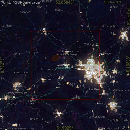
Analysis of Wunstorf night lights 2016
Square area 10x10 km:
 1.77%
1.77%90-99
2.27%80-89
1.01%70-79
0.13%60-69
1.89%50-59
0.13%40-49
1.39%30-39
2.02%20-29
0.76%10-19
1.01%0-9
87.63%Square area 50x50 km:
2.31%90-99
2.43%80-89
0.72%70-79
0.83%60-69
0.99%50-59
1.23%40-49
0.78%30-39
1.08%20-29
2.36%10-19
3.26%0-9
84.03%Clear (daylight) street map image can be seen on geolist.org.
Map coordinates:
52° 51' 1.7" North, 8° 43' 57.8" East
52° 25' 25.6" North, 9° 26' 9.1" East
51° 59' 34.4" North, 10° 8' 20.3" East
Some cities around Wunstorf sort by population:
• Garbsen
10.5 km =6.5 mi,  96°
96°
• Neustadt am Rübenberge
9.1 km =5.7 mi,  9°
9°
• Seelze
11.4 km =7.1 mi,  105°
105°
• Barsinghausen
13.8 km =8.6 mi,  176°
176°
• Bad Nenndorf
10.4 km =6.5 mi,  201°
201°
• Garbsen-Mitte
11.4 km =7.1 mi,  88°
88°
• Auf der Horst
11.3 km =7 mi, 92°
• Rodenberg
13.6 km =8.5 mi, 203°
2805761 (p: 42,080)
Sources (retrieved 2019-11-25):
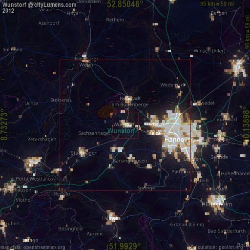
» Earth at Night: Flat Maps 2012, 2016