Bad Nenndorf night lights from space
Night Light of Bad Nenndorf (Lower Saxony) from space (Germany) Src. Average luminocity for 10x10km area is 6.1149% and for 50x50km: 7.4279%.
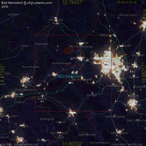
Analysis of Bad Nenndorf night lights 2016
Square area 10x10 km:
 0.63%
0.63%90-99
0.38%80-89
1.01%70-79
0.76%60-69
0.25%50-59
2.02%40-49
0.51%30-39
0.51%20-29
0%10-19
0.51%0-9
93.43%Square area 50x50 km:
1.68%90-99
1.72%80-89
0.56%70-79
0.6%60-69
0.82%50-59
1.02%40-49
0.64%30-39
0.76%20-29
1.73%10-19
2.63%0-9
87.84%Clear (daylight) street map image can be seen on geolist.org.
Map coordinates:
52° 45' 52.5" North, 8° 40' 33.3" East
52° 20' 13.3" North, 9° 22' 44.5" East
51° 54' 19.2" North, 10° 4' 55.8" East
Some cities around Bad Nenndorf sort by population:
• Wunstorf
10.4 km =6.5 mi,  21°
21°
• Seelze
16.2 km =10.1 mi,  66°
66°
• Stadthagen
12.1 km =7.5 mi,  262°
262°
• Gehrden
15.3 km =9.5 mi,  99°
99°
• Barsinghausen
6.3 km =3.9 mi,  130°
130°
• Wennigsen
14.9 km =9.3 mi,  117°
117°
• Egestorf
11 km =6.8 mi, 121°
• Rodenberg
3.2 km =2 mi,  208°
208°
2953394 (p: 10,255)
Sources (retrieved 2019-11-25):
» Earth at Night: Flat Maps 2012, 2016