Seelze night lights from space
Night Light of Seelze (Lower Saxony) from space (Germany) Src. Average luminocity for 10x10km area is 36.4381% and for 50x50km: 12.5053%.

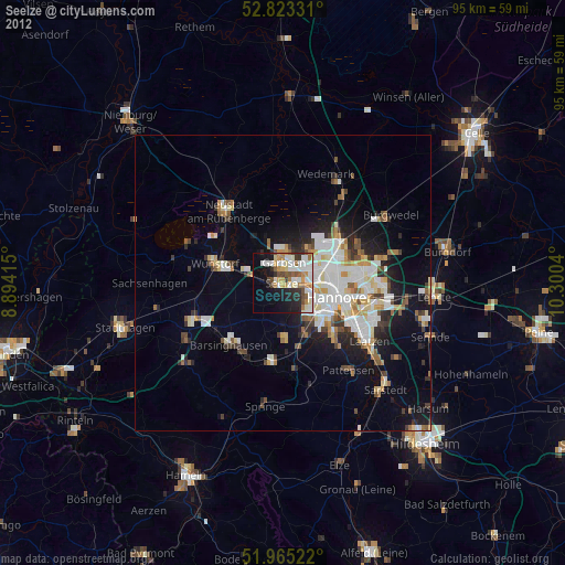
Analysis of Seelze night lights 2016
Square area 10x10 km:
 6.31%
6.31%90-99
8.71%80-89
3.66%70-79
3.03%60-69
5.3%50-59
7.2%40-49
2.27%30-39
6.06%20-29
10.86%10-19
15.15%0-9
31.44%Square area 50x50 km:
2.79%90-99
3.04%80-89
1.17%70-79
1.11%60-69
1.17%50-59
1.36%40-49
0.95%30-39
1.37%20-29
3.17%10-19
5.91%0-9
77.96%Clear (daylight) street map image can be seen on geolist.org.
Map coordinates:
52° 49' 23.9" North, 8° 53' 38.9" East
52° 23' 46.9" North, 9° 35' 50.2" East
51° 57' 54.8" North, 10° 18' 1.4" East
Some cities around Seelze sort by population:
• Hannover
9.7 km =6 mi,  107°
107°
• Garbsen
2 km =1.2 mi,  345°
345°
• Langenhagen
11.1 km =6.9 mi,  59°
59°
• Wunstorf
11.4 km =7.1 mi,  285°
285°
• Ronnenberg
9.4 km =5.8 mi,  155°
155°
• Gehrden
9.2 km =5.7 mi,  178°
178°
• Garbsen-Mitte
3.4 km =2.1 mi,  7°
7°
• Auf der Horst
2.6 km =1.6 mi, 7°
2833641 (p: 32,899)
Sources (retrieved 2019-11-25):
» Earth at Night: Flat Maps 2012, 2016