Worms night lights from space
Night Light of Worms (Rheinland-Pfalz) from space (Germany) Src. Average luminocity for 10x10km area is 32.2913% and for 50x50km: 20.132%.
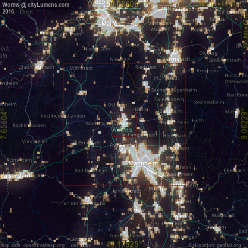
Analysis of Worms night lights 2016
Square area 10x10 km:
 5.18%
5.18%90-99
7.14%80-89
2.24%70-79
1.96%60-69
2.24%50-59
2.38%40-49
5.6%30-39
3.36%20-29
11.48%10-19
49.58%0-9
8.82%Square area 50x50 km:
3.85%90-99
4.45%80-89
1.64%70-79
1.67%60-69
1.95%50-59
2.01%40-49
2.29%30-39
2.98%20-29
6.54%10-19
13.47%0-9
59.15%Clear (daylight) street map image can be seen on geolist.org.
Map coordinates:
50° 5' 9.8" North, 7° 39' 21.7" East
49° 37' 58" North, 8° 21' 33" East
49° 10' 30.9" North, 9° 3' 44.2" East
Some cities around Worms sort by population:
• Frankenthal
11 km =6.8 mi,  182°
182°
• Lampertheim
9 km =5.6 mi,  115°
115°
• Bürstadt
7.3 km =4.5 mi,  81°
81°
• Bobenheim-Roxheim
5 km =3.1 mi, 181°
• Biblis
9.7 km =6 mi,  47°
47°
• Osthofen
8.3 km =5.2 mi,  342°
342°
• Heidesheim
13.1 km =8.1 mi,  244°
244°
• Lambsheim
14.2 km =8.8 mi,  201°
201°
2806142 (p: 81,099)
Sources (retrieved 2019-11-25):
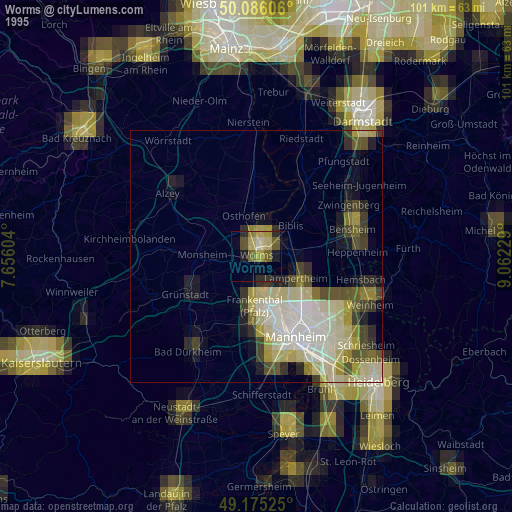
» NASA, Earths city lights 1995
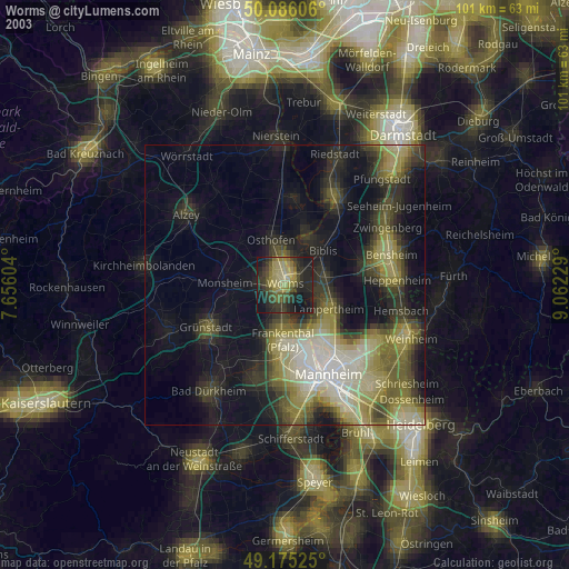
» NASA city lights 2003
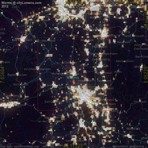
» Earth at Night: Flat Maps 2012, 2016